I’m Becoming a Cloud Chaser

On the Sunday before Thanksgiving, I hiked to Mt. Lowe with my friend Etienne starting from the Upper Sunset Ridge Trail.  It rained the previous couple days and it was raining Saturday night when Etienne and I were planning our Sunday hike.  Since I usually avoid hiking in the rain, I had already ruled out a solo hike.  So, I’m definitely not a storm chaser.  As we texted back and forth and I was deciding whether or not I wanted to go, I studied the hourly weather report.  It indicated that at 7 am the chance of rain would go down to 10% and remain that way for the rest of the day.  Significantly, the weather icon on my weather application showed the sun with clouds.  I’ve found that hiking just before a storm or just after it are amazing times to be on the mountain.  A lot of what amazes me has to do with what the clouds are like at those times.  It was the possibility to walk up into the clouds, make it over them, and see the wonderful light generated as the sun reflects off of them or breaks through them that inspired me to accept Etienne’s invitation a go on this hike with the potential for rain in the forecast.  After I sent him my last text agreeing to go, I realized I’m becoming a cloud chaser.

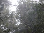
When we left my house it looked like it could rain at any moment and there was no sign of the sun.  The clouds were low and we couldn’t see any peaks.  This meant we were at least guaranteed to be able to walk in them.  It actually didn’t take long to reach them.  We were among them about half way up the Sunset Ridge Trail.

About half way up the Sunset Ridge trail among the clouds.

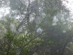
It turned out that they were moving up the mountain with us essentially filling in all of Millard Canyon as they made their way over the San Gabriels.  Depending upon whether or not it was misty where I was hiking, I felt like I was either walking next to them or through them.  The haunting impact that the clouds create allowing the burned trees to stand in silhouette always appeals to me.  The trees stand out in a way that they no longer can on sunny days having lost all or most of their foliage.  The view out is temporarily gone and once again these trees dominate the viewable landscape.  Under these conditions, the vegetation that is making a comeback appears more vibrant as moisture and the grey surroundings help emphasize their green presence.

As we made it higher along the Sunset Ridge Trail we started to feel more like we were in the clouds instead of next to them.

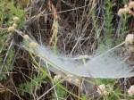
Arriving near the top of the Sunset Ridge Trail allowed us to view out toward the city for the first time.  We finally saw the sun breaking through the clouds and some patches of blue sky.  However, we were not over the clouds and couldn’t see far off into the distance.  Mostly we could see the path they were making over the mountains.

Near the top of the Sunset Ridge Trail looking toward Echo Mountain.

Although our view out toward the ocean was still blocked by clouds, the initial view up the Upper Mt. Lowe Railway Trail yielded plenty of hope that our continued trek up the mountain would lead us to a view above the clouds.

View up the Upper Mt. Lowe Railway Trail.

Soon it became clear that the blue sky we saw was a temporary break in the clouds and not a preview of sunshine and views over the clouds waiting for us further up the mountain.  By the time we were heading up the East Mt. Lowe Trail along the south slope of Mt. Lowe, it was obvious that the clouds were rising in height as they made it over the ridge line that includes Muir Peak and Inspiration Point only to drop down again into Eaton Canyon to the east and Grand Canyon to the West.  The odds of hiking over the clouds on this day were rapidly diminishing.

Clouds coming over the ridge line including Muir Peak to the left, Inspiration Point at the saddle in the center and two unnamed peaks to the right.

Turning the corner and heading up the east slope of Mt. Lowe, Mt. Disappointment and San Gabriel Peak were clearly visible below the clouds.  Unlike a prior day, the clouds were going over San Gabriel Peak instead of around it.

Etienne walking up the east slope of Mt. Lowe next to the clouds as they made their way up Eaton Canyon.

Heading up the north slope of Mt. Lowe, the clouds were swirling around the mountain coming up from both canyons.  Watching the flow of the clouds was loosely similar to watching waves come in on a rocky beach with cliffs.  The clouds were swirling around, moving down and then up, coming together and meeting from the two canyons and hiding San Gabriel Peak and Mt. Disappointment in the process, and then moving apart and allowing a patch of blue to be seen.

View of Mt. Disappointment and San Gabriel Peak from the south slope of Mt. Lowe. Mt. Markham is overcome by clouds.

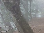
Etienne in the clouds on Mt. Lowe

The only remaining question to be answered was what would the conditions be like on the peak of Mt. Lowe.  Would we be engulfed in clouds as was the case of Mt. Markham during time we were able to try and view it, or would we have moments where we could look out a reasonable distance as it was clear one could do periodically from San Gabriel Peak and Mt. Disappointment?  As we made it to the junction with the Upper Sam Merrill Trail, we were already in the clouds.  A large part of lunch was shared in the clouds at the summit.  However, there were some nice moments when the swirl of clouds rose high enough to allow a little view.

View from Mt. Lowe when the clouds rose high enough for us to no longer be in them.

The way back down yielded similar experiences with the clouds until we got to a point on the Upper Mt. Lowe Railway Trail where we far enough under the clouds that we could see out to the ocean.

View from the Upper Mt. Lowe Railway Trail

The clouds were now higher than in the morning when they blocked the view of the city and lower canyons.  The rest of our day was under the clouds with great clear views of the canyons, city, and ocean beyond.  For me, chasing clouds is a dynamic experience worth repeating whenever possible.

Spider Webs For Halloween

Thankfully, I don’t have any spooky Halloween hiking experiences to share.  However, Halloween decorations (especially ones including spiders and spider webs) inspired me to give an account of my day hiking among numerous unexpectedly visible spider webs.  It was on a gloomy June day in 2011 with heavy mist in the air and some brief periods of light rain.  I was hiking in an area I had hiked numerous times before and had never seen many webs.  Perhaps a few in a day at most.  However, the misty air brought dew onto the webs magnificently exposing them.  Over the course of the day I easily saw hundreds of webs, but only one spider.  It was another one of those times where weather dramatically alters the experience of the day and radically changes what I focus on.  In addition to how many webs there were, I found it surprising how many of the webs were right next to each other.  The forest was just teeming with them–which underscored their normal effectiveness at appearing invisible to their spider’s prey.  I remember my mind wandering at one point and thinking of the Invisible Man suddenly becoming seen in the rain.  Enjoy the gallery below of some of  those spider webs as this blog’s Halloween Treat and have a happy and safe Halloween.

Science on Mt. Harwood

Mt. Harwood is a peak that the Devil’s Backbone Trail traverses the south side of connecting Baldy Notch to Mt. Baldy.  The way to the summit isn’t obvious and is part use trail and part scree scramble.

View looking toward Mt. Harwood heading down the Devil’s Backbone Trail from Mt. Baldy.

Since hiking to Mt. Baldy is reasonably strenuous on it’s own, most people don’t bother peak bagging Mt. Harwood.  I didn’t the first several times either.  However, on one of my training hikes for Mt. Whitney I met another hiker (Charles) on Mt. Baldy who told me about his summit of Mt. Harwood as well as some science equipment near the summit. I had to see it myself and learn more clearly what the scientists are researching.

Description of the research objective of learning about the movement of the Earth’s crust.

View of the EarthScope Plate Boundary Observatory Station with Mt. Harwood in the background.

I enjoyed looking at Mt. Baldy from another vantage point as I headed up to the summit.

View toward Mt. Baldy heading up the scree scramble to Mt. Harwood.

Heading down from the summit and looking toward Mt. Baldy yields probably the most comprehensive view of the last portion of the Devil’s Backbone Trail leading up to Mt. Baldy

View of Devil’s Backbone Trail and Mt. Baldy.

Being Able To Decide What Weather I Want To Be In

Hiking has taught me to pay more attention to the weather.  As of last Sunday, I’ve now internalized the reality that there are numerous days in the year when I can decide what weather I want to be in.  Living within an hour of both the Pacific Ocean and trailheads leading to peaks as high as Mt. Baldy’s 10,064 foot elevation yields opportunities to take advantage of elevation differences.

Last Saturday, I went on a family and friends hike.  My wife and I left our house under cloudy and misty sky’s.  We didn’t see an blue skies or the sun until we were partway up Mt. Baldy road.  By the time we made it to Icehouse Canyon to start our hike, we were out of the clouds and into clear sunny skies.  Coming down the Chapman Trail allowed us to see out of the canyon and view the cloud cover that most people in the LA area remained below for the day.

View of cloud cover down Icehouse Canyon with Mt. Wilson and San Gabriel Peak off in the distance.

On Sunday, I woke up to the same weather.  The ground was wet and the air was misty with clouds as far as I could see.  Initially I was disappointed as I had planned to play paddle tennis with my cousin in Marina Del Rey.  The weather report showed 30% chance of rain and I decided it wasn’t worth the risk to drive out and have the courts become unplayable after a few minutes of rain.

At that moment I finally realized that staying below the cloud cover could be a choice instead of a situation I had no control over.  I walked to the end of my block and looked at Mt. Lukens.  The clouds were low enough covering half the height of the mountain that it looked possible that I could get above the clouds again as I did the day before.

So, I set out to go on a short hike to San Gabriel Peak where I had once unintentionally found myself above the clouds before and it was one of the peaks that were above the clouds the day before.  Driving up to Eaton Saddle, I found myself in the clouds and either in mist or light rain.  I drove higher up to Mt. Wilson only to find it was also still in the clouds.  Admittedly, this reality was humbling.  Perhaps I didn’t have a choice after all.  Fortunately, I continued up Angeles Crest Highway and by Newcomb’s Ranch I found myself in the sun.  Having only brought a small snack and water for a short hike, I settled on hiking the Mt. Waterman Trail.

At the trailhead, it was completely sunny and clear.  However, as I followed the trail heading east up the mountain toward the Kratka Ridge, I started seeing a light mist as the clouds were just making it over the Ridge.

A light mist of clouds making it’s way over the Kratka Ridge.

I thought that it was possible that I wasn’t so much above the clouds as I was in front of their path over the mountain range.  So, I picked up my pace trying to make it up to the summit before clouds had a chance to overtake it.  It didn’t take long after the trail changed direction and for me to reach high enough ground to find myself once again in the sun.

Back in the sun looking across the cloud cover toward Mt. Baldy.

With clear skies at the summit, I enjoyed the uncommon opportunity to stare both up at a cloudless sky and across the cloudscape.

View from Mt. Waterman toward the east and across the cloudscape toward Mt. Baden-Powell

Looking toward the west where nothing is tall enough to rise above the cloudscape as it makes it’s way over the mountains.

Making my way down toward my car found me inside the clouds as they made their way over the Kratka Ridge.  This suggested to me that earlier I was at times both over and in front of the clouds as they moved north.  Along the way down the mountain I felt a few drops, but mostly just some mist.

In the clouds only a couple hundred feet below the summit.

Once I got to the point in the trail that I started heading back west across the north face of Mt. Waterman, I found myself exiting the clouds.

Back in the sun and clear skies along the north face of Mt. Waterman.

On the ride home I thought about how liberating it felt to be able to decide what weather I wanted to be in for the day.  Playing around the edge of the clouds, being just above them, just in front of them, and at times inside them or under them (at home and on the way to and from the trail) made for a wonderfully dynamic day.

The West Baldy Illusion

The first time I hiked to West Baldy I mistakenly thought it was Mt. Baldy until I reached West Baldy and looked back.  When I reached what I later learned was Mt. Baldy from the Devil’s Backbone Trail, there was only a publicly affectionate young couple on the summit who I didn’t want to disturb.  It turns out they were blocking my view of the summit marker.  Looking south I saw what appeared to be a higher peak and assumed it was Mt. Baldy.

View of West Baldy (elevation 9,988′) from Mt. Baldy (elevation 10,064′). Note: photo is taken from just below the summit marker.

So, I headed down along what turned out to be the Old Baldy Trail that leads to the Visitors Center.  Near the saddle I realized I needed to head over to the ridge where I found the West Baldy Trail which I learned on the way back directly connects the two summits.

View of West Baldy along the West Baldy Trail near the saddle.

Reaching what turned out to be West Baldy and looking back I realized I was on a shorter peak.

View of Mt. Baldy from the summit West Mt. Baldy

View toward Mt. Baldy from just below the peak of West Baldy

I find it an interesting illusion and worth the short 1.1 mile round trip to fully experience.