A squirrel with bubonic plague was found in Angeles Forest. Three Campgrounds have been closed as a result while officials attempt to control flees. Closed campgrounds are: Broken Blade, Twisted Arrow, and Pima Loops. Call the health department’s “Vector Management Program” at (626) 430-5450 if you see dead ground squirrels.
Tag Archives: Angeles Forest
Weekend at Kelly Camp
I spent last weekend at Kelly Camp. Fortunately I hiked there the week before and already knew there is no water at Kelly Camp. So I already planned my hikes around getting water at Columbine Spring prior to going. This trip was mostly about testing gear and getting more familiar with backpacking for some of the people I’m going to Mt. Whitney with at the end of July.
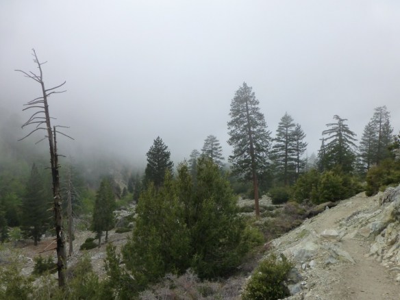
The weather Friday was cloudy and I was a little apprehensive that it might rain as the clouds were threateningly dark. Etienne and I hiked through the mist up to Icehouse Saddle where we finally got a glimpse of blue sky shortly after hearing some thunder. The clouds were making it up the canyon and I wasn’t sure if we were above them as much as we were ahead of their path.
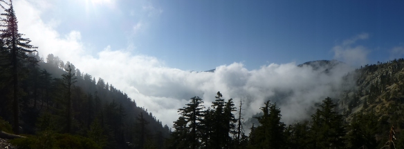
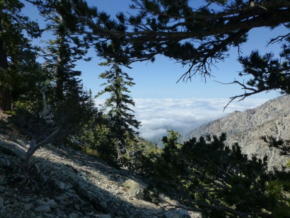
Clouds breaking up as seen from the Ontario Peak Trail between Icehouse Saddle and Kelly Camp. (click to enlarge)
At the saddle we contemplated turning back as neither of us was enthusiastic about the prospect of spending the night in the rain. As we were considering our options it appeared that the clouds were breaking up. So we decided to stay the night. Although it was sunny at first at Kelly Camp, mist periodically made it up the mountain with the wind. Fortunately, a little mist was the extent of the moisture we experienced. It got windy and cold early and we sought shelter in our tents much earlier than if it was warmer.
On Saturday we hiked down to Icehouse Saddle and headed up the Cucamonga Peak Trail. When we got to the saddle between Buckhorn Peak and Cucamonga Peak we got our first view of the cloud cover below which extended below us as far as we could see. It was a great view that we saw numerous times going up the switchbacks of the trail. However, the clouds looked like they might make their way up the mountain at some point which I would have been more excited about as a possibility if I wasn’t planning to spend another night at Kelly Camp.
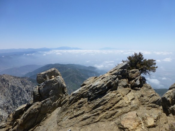
We stayed at Cucamonga Peak for a while cooking lunch, enjoying the view, and watching the clouds break up yielding the sunny day the weather report predicted. We made it back down to Columbine Spring ahead of schedule so I hiked with Etienne down to the lower junction with the Chapman Trail where I met my wife and our friend Lorenzo.
While Etienne hiked down to the trailhead, the three of us the hiked up to Columbine Spring to get water for the night and next day. We then made it up to a sunny Kelly Camp and enjoyed a much warmer night.
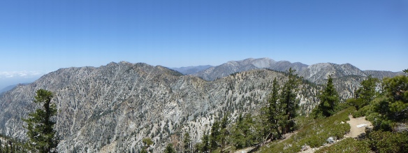
On Sunday we were on the trail around 7:00 enjoying the fantastic morning light on the way to Ontario Peak where we stayed a while to snack and enjoy the view.
After that we hiked to Bighorn Peak which provided excellent training going up the final steep slope to the peak and contending with windy conditions that we didn’t experience anywhere else that day.
From Buckhorn Peak we went back to Kelly Camp, cooked lunch, and packed up for our trek back down Icehouse Canyon.
Photos of Cucamonga Peak Trail (multiple trips)
Photos from Cucamonga Peak (multiple trips)
Photos of Ontario Peak Trail (multiple trips)
Photos from Ontario Peak (multiple trips)
Photos of Bighorn Peak Trail (multiple trips)
Photos from Bighorn Peak (multiple trips)
Some Colorful Lizards
Wednesday I hiked to Mt. Wilson as my last training hike from my Grand Canyon Trip (I’m leaving within the hour). I enjoyed watching some colorful lizards going at it for a good ten minutes. Here’s some photos (click to enlarge). If you know what kind of lizards these are, please comment. I should have Grand Canyon photos and stories posted in around a week.
Gallery Update #11: Snags
My Gallery Updates are about sharing photos I’ve added to the gallery section of this site. The galleries are my way of creating a visual approach to searching for hikes by having collections of photos that link to information about hiking to where each photo was taken.
This week I added a new Snags Gallery. One of my favorite blogs (Backyard Biology) recently posted a piece (Dead tree wildlife condo) describing the role that snags (dead or dying trees that are still standing) play in nature. Previously I didn’t know there was an ecological term for the many standing dead trees I photograph. Here’s a few in different contexts.
Above photo taken from the Devil’s Backbone Trail.
Above photo taken from the Islip Ridge Trail.
Above photo taken from the Mt. Hillyer Trail.
Above photo taken from the Silver Moccasin Trail near Little Pines Loop.
Above photo taken from the Pacific Crest Trail between Islip Saddle and Little Jimmy Campground.
Sunset From Mt. Markham
My friend Lorenzo and I were treated to a marvelous sunset last Sunday on our hike from Eaton Saddle to Mt. Lowe, Inspiration Point, Muir Peak and Mt. Markham. With a sky of interesting cloud formations for the sun to reflect upon from below and our vantage point above the mountains where it would eventually set from our view, photographic opportunities were plentiful. Looking through the photos, it appears I was in the mood to take numerous zoom shots (some a little abstract). A representative sample is in the gallery below (click to enlarge).
The original plan was to just hike to Mt. Muir. However, my wife was getting over a cold but still wanted to hike. So, we took an extra car so she could turn back if she felt like it–which she did close to Mt. Lowe. With only Lorenzo joining us on our weekly family-friends hike, it was easy to alter plan and add hiking to Mt. Lowe as a good stopping place for Debbie to rest a while and turn back.
Over the rest of the day, Lorenzo and I took our time and talked to a number of hikers along the way. I even convinced two of them to give Muir Peak a try (in a recent post I mentioned how Muir Peak is under appreciated).
By the time we got back to the saddle between Mt. Lowe and Mt. Markham it was late enough to be clear that the sunset was going to be special. We knew it would be wonderful to watch the sun make its way below the clouds and then set below the mountain tops which we would look down upon. We also knew that if we went for it, we would need headlamps to find our way back to our cars.

View down Bear Canyon toward Mt. Lukens near the saddle between Mt. Lowe and Mt. Markham just after deciding to summit Mt. Markham. Note the light from the sun breaking through the clouds from above.
The Mt. Markham Trail is a “use trail” that follows the ridge up to the peak with a few spots that are steep and rocky that many hikers might find uncomfortable to traverse being in that grey area that is truly neither hiking nor rock climbing.
The orientation of the trail is such that hiking up to the peak required us to turn our backs to the sunset. So, we would look back often but also really pay attention to changes in light to alert us to a more meaningful change in the path of the sun through the clouds.
The peak of Mt. Markham is essentially a long ridge that slopes downward slightly from the south where it is first reached to the north where it yields a great view of San Gabriel Peak and Mueller Tunnel. We made it to the south end while the sun had just started making its journey between the clouds and mountain tops (from our vantage point).

View from the south end of Mt. Markham with Mt. Lowe below on the left and Mt. Lukens beyond on the right.
By the time we made it to the north end of the peak, the sun was getting low enough that the longer angle of light started to produce some great colors.
There were two realities that made us head back to the south end of the peak. First was the fact the the north end blocks some of the view, and second we needed to get far enough along the trail so that we wouldn’t need our headlamps until after we had traversed the steeper sections. As we made it down the trail, the clouds started reflecting the colors of the changing light. The sky soon was filled with yellow, orange, and red. It was at this time that I took most of my zoom shots.
Fortunately we made it back to the saddle before needing to put on headlamps. This post was possible only because Lorenzo decided to loan me his camera (I forgot mine at home). While we had a system in place to remember who took which pictures for most of the day, it was great of him to allow me to use it almost the whole time we we trekking on Mt. Markham so that I could make this post. Fortunately, we both use the same model of camera.

