
Back to Rock Tanks Loop Photos
This peak is unnamed and not described in any literature I am aware of. Thus, the name given here is unofficial and for reference purposes only.
Elevation: 2152′ (Unofficial GPS height reading)
Hikes:
- This peak is the high point on a ridge leading up from the saddle dividing Palo Verde Wash and Smoke Tree Canyon in Anza-Borrego Desert State Park. It is accessed by a short peak scramble to the ridge followed by a ridge walk. To get to the saddle, follow instructions for the Rock Tanks Loop described in Afoot & Afield: San Diego County. I hiked a slightly different path, skipping the rock tanks and walking back on the highway instead of setting up a shuttle. Stats: 8.6 miles, 1450′ gain and loss. First Hike: 1-10-2015.
ABDSP Peak 2152 Views (Click image to view larger size)
-
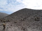
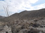
- View from saddle looking toward the beginning of the ridge.
-

- View near the ridge
-

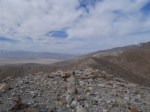
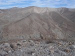
- View from the ridge
-

- View from the ridge
-

- View from the ridge
-
- View from the ridge
-

- View from the ridge
-

- View from the ridge
-

- View from the ridge
-

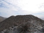
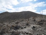
- Final approach to the peak
-

- View from the peak
-
- View from the peak
-
- View from the peak
-
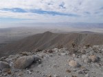
- View from the peak
-
- View from the peak
-

- View from the peak
-

- View from the peak
-
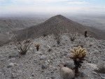
- View of the peak (left) and the first bump along the ridge from the trail leading down to Smoke Tree Canyon.
-
- View of the first bump (left) and the ridge from the trail leading down to Smoke Tree Canyon.
