Blog Post: Why I’m Participating in the 52 Hike Challenge
Website: Official 52 Hike Challenge Website
I started on February 3, 2016. I altered the rules of the challenge to require that all hikes need to be completed in Angeles National Forest and all hikes need to be different. This page merely lists the hikes. With each hike listed below, I will provide the number that corresponds to the hike number for my 2016 hiking journal. Just click on the link provided in the parenthesis and scroll down to that number to find a track map, photo, and possibly links to other information.
Hike #52 (2016 #70) on December 29. From Bailey Canyon, I followed the Bailey Canyon Trail to Jones Peak and returned the same way. Stats: 6.0 miles, 2200′ of gain and loss.
Hike #51 (2016 #69) on December 27. From Chantry Flats, I followed the Gabrieleno Trail to the Upper Falls Trail (a.k.a. Lower Gabrieleno Trail) to the Gabrieleno Trail to the Mt. Zion Trail to Mt. Zion. From Mt. Zion, I followed the Mt. Zion Trail and the Upper Winter Creek Trail to Chantry Flats. Stats: 9.7 miles, 1980′ of gain and loss.
Hike #50 (2016 #68) on December 24. From Eaton Canyon, I followed the Eaton Canyon Trail to Eaton Falls. Stats: 3.8 miles, 550′ of gain and loss.
Hike #49 (2016 #67) on December 18. From the Switzer Picnic Area, I followed the Gabrieleno Trail, Bear Canyon Trail, and Switzer Falls Trail to Switzer Falls and returned the same way with Lorenzo. Stats: 3.8 miles, 990′ of gain and loss.
Hike #48 (2016 #65) on December 12. From Red Box, I hiked to Strawberry Peak and back the same way. Stats: 7 miles, 1845′ of gain and loss.
Hike #47 (2016 #64) on December 8. From Red Box; I hiked the Gabrieleno Trail down to the Upper Switzer Picnic Area and returned the same way. Stats: 7.0 miles, 1340′ of gain and loss.
Hike #46 (2016 #63) on December 1. From the upper gate at Millard Canyon, I hiked the Upper Sunset Ridge Trail to Echo Mountain. Stats: 7.2 miles, 1612′ of gain and loss
Hike #45 (2016 #62) on November 25. From the south parking area at Chilao near Little Pines Loop, I hiked the Silver Moccasin Trail to Horse Flats, the Mt. Hillyer Trail to Mt. Hillyer, the Mt. Hillyer North Hiker’s Trail to Horse Flats, walked through Horse Flats and followed the Silver Moccasin Trail back to Chilao. Stats: 6.8 miles, 1345′ of gain and loss.
Hike #44 (2016 #61) on November 19. From Shortcut Saddle, I hiked the Silver Moccasin Trail to West Fork Campground. Stats: 6.8 miles, 1700′ of gain and loss.
Hike #43 (2016 #60) on November 17. From Chilao (at Little Pines Loop), I hiked the Silver Moccasin Trail and Vetter Mountain Road to Mt. Vetter. Stats: 9 miles, 1250′ of gain and loss.
Hike #42 (2016 #59) on November 11. From Red Box, I hiked the Gabrieleno Trail to Valley Forge Campground. Stats: 4.6 miles, 1160′ of gain and loss.
Hike #41 (2016 #58) on October 2. From Baldy Notch reached by ski lift, I hiked the Three Tees Trail to Thunder Mountain, Telegraph Peak, and Timber Mountain and returned without re-summiting the peaks. Stats: 10.5 miles, 3407′ of gain and loss.
Hike #40 (2016 #57) on September 25. From Crystal Lake, I hiked the South Islip Ridge Trail to Mt. Hawkins and returned via the North Islip Ridge Trail, Windy Gap Trail, the road to Deer Flat, the short Sunset Ridge Loop Trail at Deer Flat, and the Lost Ridge Trail back to Crystal Lake with David, Verner, Toby, ET, and Brian. Stats: 11 miles, 2835′ of gain and loss.
Hike #39 (2016 #56) on September 18. From Dawson Saddle, I hiked the Dawson Saddle Trail to the Pacific Crest Trail to Mt. Hawkins to the Hawkins Ridge Trail to Middle Mt. Hawkins and South Mt. Hawkins. On the way back, I summited Throop Peak and followed its west ridge down to the Dawson Saddle Trail. Stats: 13.2 miles, 3420′ of gain and loss.
Hike #38 (2016 #55) on September 11. From Vincent Gap, I hiked the PCT to Mt. Baden-Powell and followed the east ridge down to the PCT and to Mt. Burnham. I followed the PCT the entire way back to Vincent Gap. Stats: 10 miles, 3456′ of gain and loss.
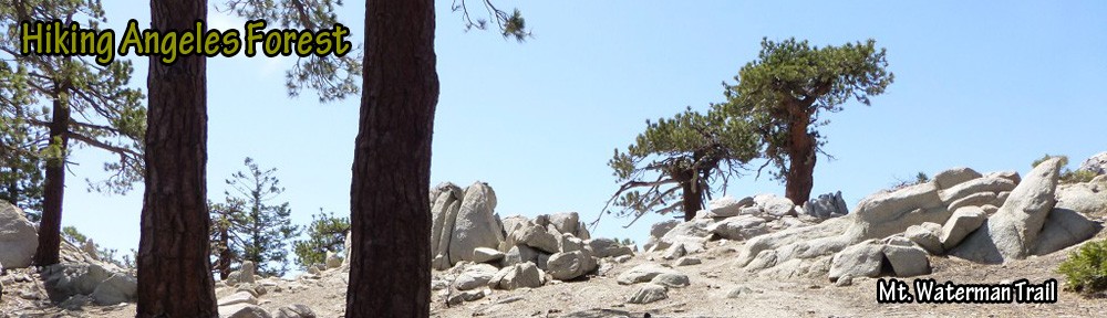
Hike #37 (2016 #54) on September 4. From the Vista Day Use Area, I hiked Kratka Ridge to the summit of the same name and then followed the ridge (sometimes x-country) to the Mt. Waterman Trail and up to Mt. Waterman. To return, I followed the Mt. Waterman Trail down to Kratka Ridge, followed the ridge a short distance until it split off to a road which I followed down to Angeles Crest Highway (near mile marker 59.10), and followed Angeles Crest back to the Vista Day Use Area. Stats: 9.5 miles, 2270′ of gain and loss.
Hike #36 (2016 #53) on September 1. From Buckhorn Campground, I hike the Burkhart Trail to Burkhart Saddle and then followed Pleasant View Ridge to Will Thrall Peak and Pallet Mountain #2 and returned the same way. Stats: 12.2 miles, 4040′ of gain and loss.
Hike #35 (2016 #52) on August 28. From Islip Saddle, I hiked the Pacific Crest Trail to Throop Peak. On the way back I summitted Mt. Hawkins and followed it’s west ridge back down to the Pacific Crest Trail and returned to Islip Saddle. Stats: 11.3 miles, 2698′ of gain and loss.
Hike #34 (2016 #51) on August 24. From Eagles Roost, I hiked the Pacific Crest Trail and Pleasant View Ridge to Mt. Williamson. Stats: 5.8 miles, 1899′ of gain and loss.
Hike #33 (2016 #49) on July 21. From Mile Marker 54.10 along Angeles Crest Highway, I hiked the Pacific Crest Trail to Cloudburst Summit and then followed it around Bump 6903 from the north face. I then followed the Winston Ridge use trail to Winston Ridge Peak. On return, I went around Bump 6903 on the west face and summited Winston Peak before returning to Cloudburst Summit and following the Pacific Crest Trail back to parking. Stats: 11.1 miles, 2353′ of gain and loss.
Hike #32 (2016 #48) on July 17. From Islip Saddle, I hiked the PCT and Pleasant View Ridge to Mt. Williamson, Middle Mt. Williamson, West Mt. Williamson and Pallett Mountain. Stats: 9.1 miles, 3877′ of gain and loss.
Hike #31 (2016 #47) on July 14. From the Icehouse Canyon Trailhead, I hiked Icehouse Canyon and the Three Tee’s Trail to Timber Mountain and Telegraph Peak. Stats: 13.2 miles, 4915′ of gain and loss.
Hike #30 (2016 #44) on July 3. From Islip Saddle, I hiked the Pacific Crest Trail and Mt. Islip Trail to Mt. Islip and returned via the trail to Little Jimmy Campground and the Pacific Crest Trail. Stats: 6.6 miles, 1890′ of gain and loss.
Hike #29 (2016 #42) on July 1. From Manker Flats, I hiked the Baldy Bowl Trail to Mt. Baldy and came back via the Devil’s Backbone Trail. Stats: 11 miles, 3904′ of gain and loss.
Hike #28 (2016 #38) on June 18. From the Mt.Waterman Trailhead along Angeles Crest Highway, I hiked the Mt. Waterman trail to Mt. Waterman (small loop at the summit).Stats: 6.5 miles, 1320’gain and loss.
Hike #27 (2016 #37) on June 16. From Vincent Gap, I hiked the Pacific Crest Trail to Mt. Baden-Powell. Stats: 7.8 miles, 2814′ of gain and loss.
Hike #26 (2016 #36) on June 12. From Dawson Saddle, I hiked to Mt. Burnham, Mt. Baden-Powell, and Throop Peak. Stats: 9 miles, 2680′ gain and loss.
Hike #25 (2016 #35) on June 5. From Dawson Saddle, I hiked the Dawson Saddle Trail and PCT to Mt. Hawkins and returned via Throop Peak with Karl and Valery. We also saw a fire on Kratka Ridge. Stats: 6.1 miles, 1475′ gain and loss.
Hike #24 (2016 #34) on June 2. In Angles National Forest and San Bernardino National Forest, from Icehouse Canyon, I hiked the Icehouse Canyon Trail to Icehouse Saddle and then followed the Cucamonga Peak Trail to Cucamonga Peak. I returned the same way. Stats: 12 miles, 4060′ gain and loss.
Hike #23 (2016 #31) on May 15. From Inspiration Point in Angeles National Forest, I hiked the Pacific Crest Trail to Wright Mountain in San Bernardino National Forest with Karl and Valery. Stats: 13.4 miles, 2275′ gain and loss.
Hike #22 (2016 #30) on May 14. From Islip Saddle, I hiked the PCT, Hawkins Ridge Trail, and Middle Mt. Hawkins “Hiker’s Trail” to Middle Mt. Hawkins. Stats: 8.5 miles, 2080′ gain and loss.
Hike #21 (2016 #29) on May 12. From Icehouse Canyon Trailhead, I hiked Icehouse Canyon and the Ontario Peak Trail to Ontario Peak. Although there were a few patches of snow, there was no water at Kelly Camp. On my way up Icehouse Canyon, above Columbine Springs, I saw a small bear traverse the steep slope from the ridge across from the trail down to the stream bed. Stats: 12.6 miles, 3735′ gain and loss.
Hike #20 (2016 #28) on May 8. from Red Box, I hiked to Upper Strawberry Meadow. Stats: 10 miles, 1670′ gain and loss.
Hike #19 (2016 #26) on May 1. From Mile Marker 4.50 in Big Tujunga Canyon Road, I followed the trail up to the Condor Peak Trail to Fox Peak with Etienne. Stats: 12 miles, 3000′ gain and loss.
Hike #18 (2016 #25) on Apr 30. From Colby Canyon Trailhead; Colby Canyon, Josephine Saddle Trail, and Upper Josephine Road to Josephine Peak. Stats: 8.4 miles, 2150′ gain and loss.
Hike #17 (2016 #24) on Apr 28. from Mill Creek, I followed the PCT up to the saddle with Mt. Pacifico. From there, I took Mt. Pacifico Road down to Roundtop Truck Road and followed that to Roundtop. From Roundtop, I followed the roads down to Mill Creek. Stats: 16.3 miles, 2550′ gain and loss.
Hike #16 (2016 #23) on Apr 24. From the Grassy Hollow Visitor Center, I followed the Pacific Crest Trail (with a side trip to the Observation Tower/Water Tower at Jackson Flat) to Vincent Gap and then went to Big Horn Mine with Karl and Valery. On our return to Vincent Gap, my friends made it a shuttle hike and I continued back to Grassy Hollow. Stats: 11.8 miles, 1970′ gain and loss.
Hike #15 (2016 #22) on Apr 23. From the parking lot by JPL, I hiked the Gabrieleno Trail to the dam past the Paul Little Picnic Area. Stats: 8.8 miles, 800′ gain and loss.
Hike #14 (2016 #21) on Apr 21. From South Fork, I followed the Manzanita Trail (a.k.a. High Desert Trail) to Vincent Gap and then followed the PCT and the spur trail to Lamel Springs. Stats: 14.2 miles, 3640′ gain and loss.
Hike #13 (2016 #20) on Apr 17. From Devil’s Punchbowl parking lot, I followed the High Desert Trail and Devil’s Chair Trail to Devil’s Chair with Karl and Valery. Stats: 7.4 miles, 1185′ gain and loss.
Hike #12 (2016 #19) on Apr 16. From Islip Saddle, I followed the PCT and Pleasant View Ridge up to Mt. Williamson and back on a very windy day. Stats: 4.2 miles, 1544′ gain and loss.
Hike #11 (2016 #18) on Apr 14. From Three Points trailhead, I followed the Mt. Waterman Trail. A large number of downed trees blocking the trail (especially between 2 miles in until the JCT with the Twin Peaks Trail) got a little tiring for me on my first day back into the forest after three weeks on the East Coast. So, I decided to go around the mountain instead of doing an out and back. Due to the added mileage involved, I skipped the summit and continued along the Mt. Waterman trail to Angeles Crest Highway and followed that to Cloudburst Summit. From there, I followed the PCT back to Three Points. Stats: 14.1 miles, 2640′ gain and loss.
Hike #10 (2016 #17) on Mar 18. From the Vulcan Materials Plant trailhead parking area, I solo hiked the Fish Canyon Falls Trail to the Fish Canyon Falls. Stats: 4.8 miles, 700′ gain and loss.
Hike #9 (2016 #16) on Mar 9. From Cloudburst Summit, I solo hiked the PCT down to Cooper Canyon Falls. I left the PCT on the way back so I could summit Winston Peak. Stats: 7.1 miles, 2180′ gain and loss.
Hike #8 (2016 #15) on Mar 3. From Eaton Saddle, I solo hiked to Mt. Lowe and followed the Upper Sam Merrill Trail (A.K.A. West Mt. Lowe Trail) down to the 5 points junction where I followed the Idlehour Trail to Idlehour Campground. I returned to Eaton Saddle via the East Mt. Lowe Trail. Stats: 12.1 miles, 3553′ gain and loss.
Hike #7 (2016 #14) on Feb 28. FromThree Points, I solo hiked the Silver Moccasin and Mt. Hillyer Trails to Mt. Hillyer. From Mt. Hillyer, I followed a faint hiker’s trail down to Horse Flats Campground (in front of the parking area for sites 1-3). I followed the road in the campground back to the junction leading to the Silver Moccasin Trail which I took back to Three Points. Stats: 8.8 miles, 1555′ gain and loss.
Hike #6 (2016 #13) on Feb 26. From the Switzer Picnic Area, I solo hiked the Gabrieleno Trail and Bear Canyon Trail to Bear Canyon Campground and Switzer Falls. Stats: 7.5 miles, 1860′ gain and loss.
Hike #5 (2016 #12) on Feb 21. From Red Box, I solo hiked down the Gabrieleno Trail, up the Valley Forge Trail to Eaton Saddle, through Meuller Tunnel and up to San Gabriel Peak. From San Gabriel Peak, I followed the San Gabriel Peak Trail to Mt. Wilson Road and took that back to Red Box. Stats: 8.8 miles, 2616′ gain and loss.
Hike #4 (2016 #11) on Feb 17. I solo hiked the Pacific Crest Trail from Three Points to Sulphur Springs Campground with some exploration of a potential loop route including a visit to a rock outcrop with nice views. Stats: 8.4 miles, 1065′ gain and loss.
Hike #3 (2016 #10) on Feb 12. I solo hiked from Chantry Flats following the First Water Trail to Hermit Falls. From Hermit Falls, I followed the First Water Trail back up to the 3/4 Junction sign and then continued up to Lower Winter Creek which I followed to Upper Winter Creek and took that back to Chantry Flats. Stats: 7.2 miles, 1360′ gain and loss.
Hike #2 (2016 #9) on Feb 7. I solo hiked the Devil’s Canyon Trail down to the trail camp. Stats: 5.6 miles, 1325′ gain and loss.
Hike #1 (2016 #8) on Feb 3. I solo hiked the Icehouse Canyon Trail to the upper junction with the Chapman Trail. I turned back because icy snow conditions prevented me at my snow hiking skill level from moving forward even with microspikes. Stats: 5.6 miles, 2,080′ gain and loss.
