Elevation: 6,162′
Hikes:
- Rosenita Saddle to Mt. Hillyer Lollipop: 4.2 miles, 845′ of gain and loss. First Hike: 4-30-2017.
- Chilao Flats to Mt. Hillyer Lollipop: 4.8 miles, 1,025′ of gain and loss. First Hike: 4-21-18.
- Chilao Flats to Mt. Hillyer: 5.2 miles, 1,015′ of gain and loss. First hike: 11-11-2012.
- Chilao Flats Trailhead: Pacific Crest Trail to Horse Flats; Mt. Hillyer Trail up to Mt. Hillyer, down to Rosenita Saddle and return to Chilao Flats the same way: 6.2 miles, 1315′ of gain and loss. First hike: 11-2-2012.
- Angeles Crest Highway (between Devil’s Canyon and the entrance to Chilao) to Chilao Road and down to the Silver Moccasin Trailhead and continue as described in #2 above: 6.4 miles, 1310′ of gain and loss. First Hike: 1-8-2016.
- Little Pines Loop to Mt. Hillyer Lollipop: 6.8 miles, 1345′ of gain and loss. First Hike: 11-25-2016.
- Little Pines Loop to Mt. Hillyer: 7.2 miles, 1335′ of gain and loss. First Hike: 11-14-2014.
- Three Points to Mt. Hillyer Lollipop: 8 miles, 1615′ of gain and loss. First Hike: 2-28-2016.
- Three Points to Mt. Hillyer: 8.4 miles, 1605′ of gain and loss. First Hike: 10-31-2012.
- AC MM 54.10 to Ht. Hillyer Lollipop: 11.8 miles, 2130′ of gain and loss. First Hike: 3-12-2017.
360 Degree Panorama: view
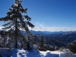
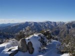
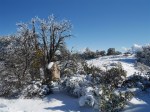
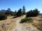
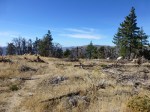
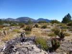
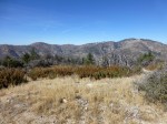
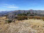
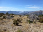
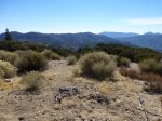
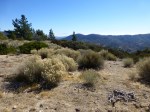
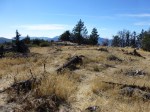
2016 Photos from Mt. Hillyer (Click to view larger image)
-

- Mt. Hillyer (01-08-2016)
-
- Mt. Hillyer (01-08-2016)
-
- Mt. Hillyer (01-08-2016)
-

- Mt. Hillyer (01-08-2016)
-
- Mt. Hillyer (01-08-2016)
-

- Mt. Hillyer (01-08-2016)
-

- Mt. Hillyer (01-08-2016)
-

- Mt. Hillyer (01-08-2016)
-

- Mt. Hillyer (01-08-2016)
2012 Photos from Mt. Hillyer (Click to view larger image)
-
- Mt. Hillyer (11-02-2012)
-

- Mt. Hillyer (11-02-2012)
-

- Mt. Hillyer (11-02-2012)
-
- Mt. Hillyer (11-02-2012)
-

- Mt. Hillyer (11-02-2012)
-

- Mt. Hillyer (11-02-2012)
-

- Mt. Hillyer (11-02-2012)
-
- Mt. Hillyer (11-02-2012)
-
- Mt. Hillyer (11-02-2012)
-
- Mt. Hillyer (11-02-2012)
-
- Mt. Hillyer (11-02-2012)
-

- Mt. Hillyer (11-02-2012)
-
- Mt. Hillyer (11-02-2012)
-
- Mt. Hillyer (11-02-2012)
-

- Mt. Hillyer (11-02-2012)
-

- Mt. Hillyer (11-02-2012)
-
- Mt. Hillyer (11-02-2012)

Pingback: New Page Additions since January 2016 | Hiking Angeles Forest
Pingback: Snow Hiking In Los Angeles: Angeles Crest To Mt. Hillyer | Hiking Angeles Forest
Pingback: Favorite Places: Rock Platform Along The Mt. Hillyer Trail | Hiking Angeles Forest