
Elevation: 6629′
Note: This peak is un-named but described in 106 Tops In The Angeles Forest on page 120. I used the UTM information from that source.
Hikes:
- From the PCT Trailhead near Angeles Crest Highway mile marker 54.10, I followed the PCT to a junction with a spur trail and I followed the spur trail (which is probably and old road) until it was blocked by fallen trees and Poodle Dog Bush. I then did a x-country scramble up to the un-named ridge and followed that to the Peak which I walked to the end of and x-country scrambled down to the PCT: 3.2 miles, 665′ gain and loss. First Hiked: 12-26-14.
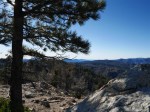
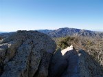
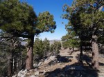
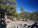
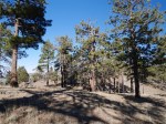
Views from Peak UTM 113016 (Click image to view larger size)
-

- Peak UTM 113016
-

- Peak UTM 113016
-

- Peak UTM 113016
-

- Peak UTM 113016
-

- Peak UTM 113016
-

- Peak UTM 113016
-

- Peak UTM 113016
-
- Peak UTM 113016
-
- Peak UTM 113016
-
- Peak UTM 113016
-
- Peak UTM 113016
-
- Peak UTM 113016
-

- Peak UTM 113016
-

- Peak UTM 113016
-

- Peak UTM 113016
