
Elevation: 5710′
Hikes:
- Start from Red Box and go down the Gabrieleno Trail to the Kenyon-Devore Trail and follow that to the pavillion (a.k.a. Cosmic Cafe) on Mt. Wilson. From Mt. Wilson, follow the Kenyon-Devore Trail back until it meets Mt. Wilson Road and follow that down to Eaton Saddle. From Eaton Saddle, hike up to San Gabriel Peak and then follow the San Gabriel Peak Trail down to Mt. Wilson Road and take that to Red Box: 13.5 miles, 3406′ gain and loss. First Hike 3-13-15
- Chantry Flat: Upper Winter Creek Trail to Mt. Wilson and back: 13.8 miles, 3960′ gain and loss. First Hike: 3-16-2011.
- Chantry Flat to Mt. Wilson: Gabrieleno Trail, Upper Falls Trail, Sturtevant Trail, Upper Winter Creek Trail Loop: 13.9 miles, 4110′ gain and loss. First Hike: 3-27-2013.
- Sierra Madre: Mt. Wilson Trail to Mt. Wilson and back: 14 miles, 4750′ gain and loss. First Hike: 3-9-2011.
- Chantry Flat: Gabrieleno to Fern Lodge JCT, Sturtevant Falls and back to Fern Lodge JCT, Upper Falls Trail to Falling Sign JCT, Gabrieleno Trail to Sturtevant Trail to Mt. Wilson. Down via Upper Winter Creek Trail: 14.6 miles, 4120′ gain and loss. First Hike: 4-12-2011.
- Chantry Flat: Gabrieleno to Lower Winter Creek to Mt. Zion down to JCT Sturtevant Trail to Mt. Wilson, down Upper Winter Creek: 15.1 Miles, 4445′ gain and loss. First Hike: 4-27-2011.
- Chantry Flat: Gabrieleno to Newcomb Pass, Rim Trail to Mt. Wilson; Upper Winter Creek, Lower Winter Creek to Chantry Flat: 17 miles, 4240′ gain and loss. First Hike: 6-1-2011.
- Angeles Crest: Silver Moccasin to West Fork Campground; Gabrieleno to Kenyon Devore to Mt. Wilson and then down the Rim Trail to Newcomb Pass; down Gabrieleno to Red Box Rincon Road down to West Fork Campground up to Angeles Crest: 17.3 miles, 4360′ gain and loss. First Hike: 6-29-2011.
- Chantry Flat: Gabrieleno to Newcomb Pass; Rim Trail to Mt. Wilson; Mt. Wilson Trail to Sierra Madre; Shuttle Hike: 17.4 miles, 3950′ gain, 5060′ loss. First HIke: 5-21-2011. First Hike: 6-1-2011.
- Chantry Flat: Gabrieleno Trail, Upper Falls Trail, Gabrieleno Trail, Sturtevant Trail to Mt. Wilson; down Rim Trail, Gabrieleno Trail to Chantry Flat: 17.5 miles, 4220′ gain and loss. First Hike: 3-20-2014.
- Sierra Madre Trailhead: Mt. Wilson Trail up to Manzanita Ridge; down Upper Winter Creek Trail to JCT Mt. Zion Trail; Mt. Zion Trail up to Mt. Zion and down to Sturtevant Camp; Sturtevant Trail up to Mt. Wilson; Mt. Wilson Trail down to Sierra Madre: 20 miles, 7005′ gain. First Hike: 4-18-12.
- Eaton Canyon to Mt. Wilson via 0.5 mile shortcut trail off the Toll Road up and back Toll Road all the way: 20.2 miles, 4750′ gain. First Hike: 5-9-2012.
- Cobb Estate: Lower Sam Merrill, Castle Canyon Trail up to Inspiration Point: Mt. Lowe Road to Idlehour Trail down to Idlehour Campground up to Mt. Wilson Toll Road to Mt. Wilson; down Mt. Wilson Road to Eaton Saddle; around Mt. Lowe via the Mt. Lowe East Trail; back down to the Cobb Estate via Sam Merrill Trails: 25.1 miles, 6604′ gain and loss. First Hike: 3-14-2012.
Views from Mt. Wilson (Click image to view larger size)
-
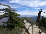
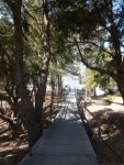
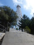
- Mt. Wilson: walkway to observation deck by Sturtevant Trailhead.
-
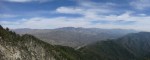
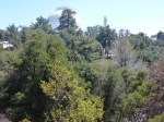
- Mt. Wilson: view from observation deck.
-
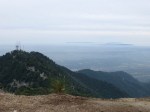
- Mt. Wilson: view toward Mt. Harvard and Catalina Island.
-
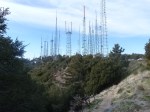
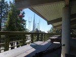
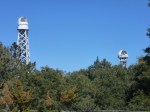
- Mt. Wilson: view toward antennas.
-
- Mt. Wilson: view toward Cosmic Cafe
-
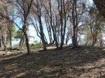
- Mt. Wilson: view from Cosmic Cafe
-
- Mt. Wilson: view from Cosmic Cafe
-
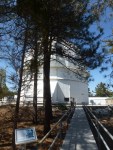
- Mt. Wilson: bridge to 100″ telescope.
-
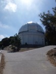
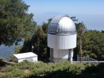
- Mt. Wilson: looking toward 100″ telescope
-
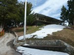
- Mt. Wilson: Larry Cotter Memorial Drinking Fountain located next to bridge to 100″ telescope.
-
- Mt. Wilson: Chara Interferometric Array.
-
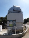
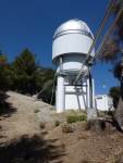
- Mt. Wilson: view toward 60″ Telescope.
-
- Mt. Wilson: view toward telescope.
-
- Mt. Wilson: view toward telescopes.
-
- Mt. Wilson: view toward telescope.
-
- Mt. Wilson: view toward telescope.
-
- Mt. Wilson: view toward telescope.
-
- Mt. Wilson: view toward telescope.
-
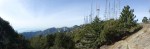
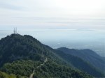
- Mt. Wilson: view toward antennas, San Gabriel Peak, Mt. Markham, and Mt. Lowe.
-
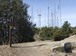
- Mt. Wilson: view toward antennas.
-
- Mt. Wilson: view toward Cosmic Cafe.
-
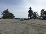
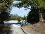
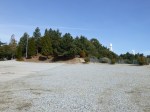
- Mt. Wilson: Cosmic Cafe Parking Lot, nice views at boulders.
-
- Mt. Wilson: looking toward Mt. Harvard and Catalina Island.
-
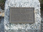
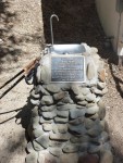
- Benjamin Davis Wilson (Don Benito) Memorial Plaque.
