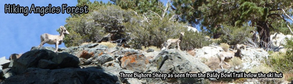
Trailhead: Eagle’s Roost Picnic Area

View of Trailhead for the Pacific Crest Trail at the north end of the Eagle’s Roost Picnic Area.
Trail: Eagle’s Roost to Mt. Williamson (all bumps)

Track map for Eagle’s Roost to Mt. Williamson from May 2017 using Backcountry Navigator (US Forest Service-2013 map) from my phone.
Stats: 6.8 miles, 2,185′ of gain and loss.
Last Hiked: 5-5-2017
Route Instructions: From the north end of the parking lot at Eagle’s Roost Picnic Area, follow the Pacific Crest Trail along Kratka Ridge, cross Highway 2 and continue following the PCT until reaching the unmarked Pleasant View Ridge junction. At the junction, turn left and follow the hiker’s trail up Pleasant View Ridge until reaching a major bend forming a T-intersection junction. Turn right and follow the spur trail the short distance to the summit of Mt. Williamson. To reach the other two bumps return to the intersection and follow the hiker’s trail further along Pleasant View Ridge. The second bump is reached via a very short spur trail up from the hiker’s trail along the ridge. The third bump exists just prior to the trail dropping steeply down and continuing to several more peaks.
Peaks:

View along Pleasant View Ridge looking toward the 2nd bump of Mt. Williamson from the junction leading to Mt. Williamson (5-5-2017)
