
Hiking Journal of my hikes completed in 2018.
Total Miles Hiked in 2018:
- 220.6 miles with 50,574′ of gain
Miles Hiked in Angeles Forest in 2018:
- 193.6 miles with 45,547′ of gain
I was barely able to get into the forest for the last half of the year and was unable to update this blog. For now, I have listed the hikes I was able to do in red text below. At some point in the future, I will add the rest of the information.
When clicked, all images below open a new tab at a larger size.
Hike #30 on December 29. I hiked the Colby Canyon Trail to Josephine Saddle with Sarah.
Stats: 4.4 miles, 1400′ of gain and loss.
Hike #29 on December 7. I hiked from Cloudburst Summit following the road down to Cooper Canyon Campground in the snow. I then went to the top of the falls. The trail leading to the base of the falls was too icy for me to use.
Stats: 6 miles, 1310′ of gain and loss
Hike #28 on October 7. In Angeles National Forest, I hiked from Islip Saddle to Mt. Islip and followed the road from Little Jimmy to the PCT on the way down.
Stats: 6.6 miles, 1580′ of gain and loss.
Hike #27 on September 23-24. In Angeles National Forest, I hiked from Dawson Saddle to Mt. Burnham with Lorenzo and camped the night. We returned the same way.
Stats: 6 miles, 1730′ of gain and loss.
Hike #26 on August 5-6. in Angeles National Forest, I hiked the Icehouse Canyon Trail to a ridge between Icehouse Saddle and Kelly Camp with Lorenzo. We camped there the night, stopping before Kelly Camp due to smoke from the fires. We returned the same way.
Stats: 8.6 miles, 2700′ of gain and loss
Hike #25 on July 27 in Mammoth Lakes, I hiked the Duck Pass Trail to Shelton Lake with some additional exploration with Debbie.
Stats: 3.9 miles, 990′ of gain and loss.
Hike #24 on July 21. In Angeles National Forest, from Dawson Saddle, I hiked to Mt. Hawkins with Debbie.
Stats: 5.8 miles, 1127′ of gain and loss.
Hike #23 on July 1 and 2. In Angeles National Forest, from Cloudburst Summit, I went on a short backpacking trip to Cooper Canyon Campground and Winston Peak with Lorenzo.

Stats: 5.8 miles, 2,270′ of gain and loss. Points of Interest: Cooper Canyon Campground, Winston Peak, un-named ridge. Trails: Pacific Crest Trail, Winston Peak Hiker’s Trails. Route description includes a track map, step by step instructions, and a link to a peak photo gallery.
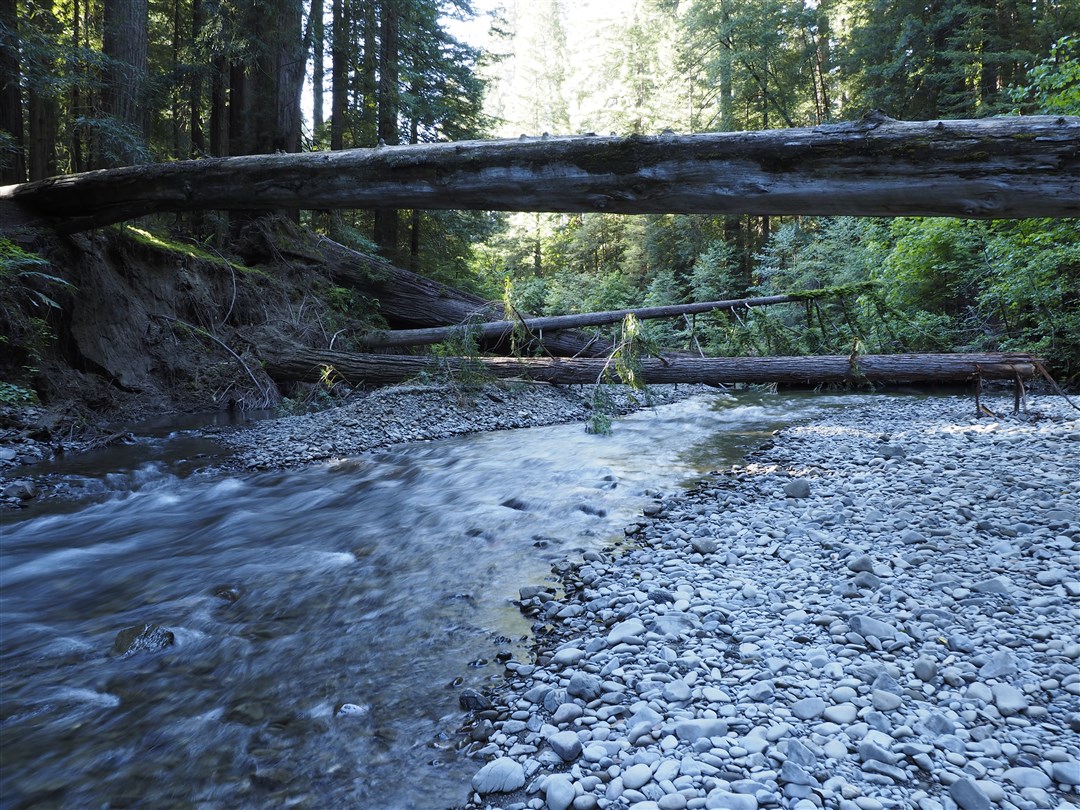
Hike #22 on May 11. In Humboldt State Redwoods Park, I hiked a portion of the Bull Creek Trail.
Stats: 3.3 miles, 445′ of gain and loss.
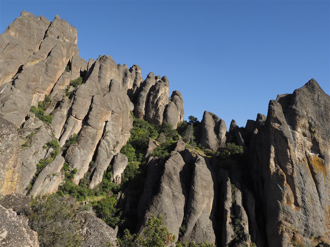
Hike #21 on May 10. In Pinnacles National Park, West Entrance, I hiked the Juniper Canyon, High-Peaks, and Tunnel Trail.
Stats: 4.4 miles, 1,332′ of gain and loss.
Hike #20 on Apr 29. In Angeles National Forest, from Mill Creek, I hiked the PCT to Mt. Pacifico and followed the road back.

Stats: 12.3 miles, 2,250′ of gain and loss. Points of Interest: Mt. Pacifico Trails: Pacific Crest Trail, Mt. Pacifico Hiker’s Trail, Mt. Pacific Road. Route description includes track map, step by step instructions, and a link to a peak photo gallery.
Hike #19 on Apr 21. In Angeles National Forest, from Chilao Flats, I hiked to Mt. Hillyer with Debbie, Monique, Collette, Giselle, and Jacqueline.

Stats: 4.2 miles, 845′ of gain and loss. Points of Interest: Mt. Hillyer, Horse Flats Campground Trails: Silver Moccasin Trail, Mt. Hillyer Trail, North Mt. Hillyer Hiker’s Trail, Horse Flats Road. Route description includes track map, step by step instructions, and links to photo galleries.
Hike #18 on Apr 14. In Angeles National Forest, from Rosenita Saddle, I hiked to Mt. Hillyer with Debbie.

Stats: 4.2 miles, 845′ of gain and loss. Points of Interest: Mt. Hillyer, Horse Flats Campground Trails: South Mt. Hillyer Trail, North Mt. Hillyer Hiker’s Trail, Horse Flats Road, Mt. Hillyer Trail. Route description includes track map, section profile, step by step instructions, and links to photo galleries.
Hike #17 on Apr 7. In Angeles National Forest, from Charlton Flats, I hiked to Vetter Mountain with Debbie.

Stats: 4.9 miles, 750′ of gain and loss. Points of Interest: Vetter Mountain Trails: Vetter Mountain Road, Silver Moccasin Trail, Vetter Mountain Trail. Route description includes track map, section profile, step by step instructions, and links to photo galleries.
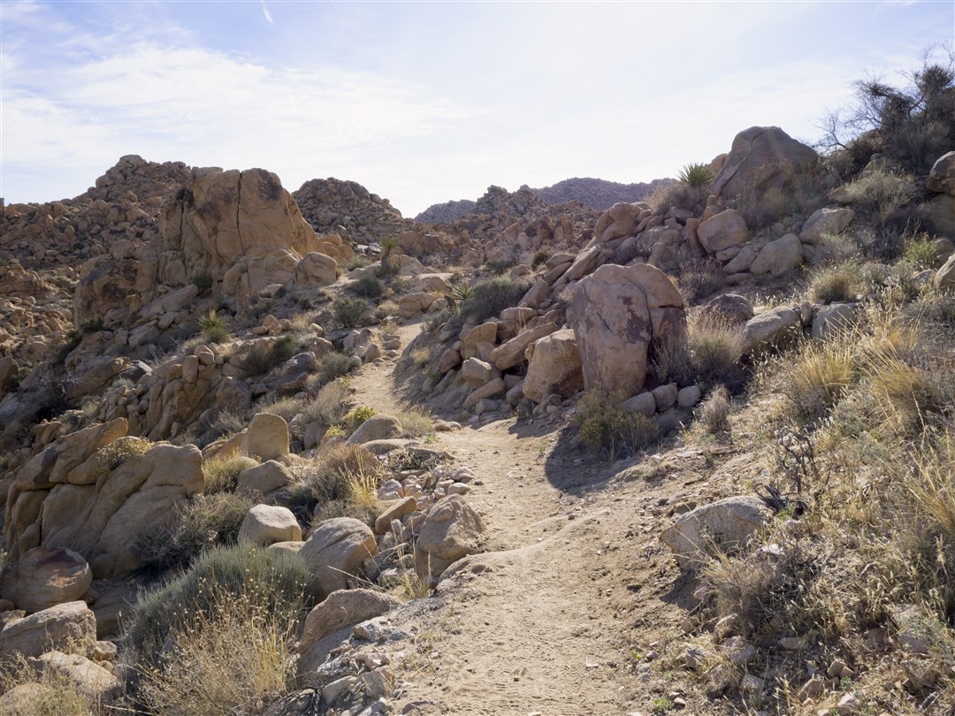
Hike #16 on Mar 31. In Joshua Tree National Park, I hiked the Boy Scout Trail as a shuttle starting in Indian Cove with Scott.
Stats: 8.1 miles, 1,420′ of gain and loss.
Hike #15 on Mar 30. In Joshua Tree National Park, I hiked the Lost Horse Mine Loop and Cap Rock Nature Trail with Scott.

Stats: 7.3 miles, 840′ of gain and loss.
Hike #14 on Mar 26. In Angeles National Forest, from Millard Canyon Trailhead, I hiked to Dawn Mine.

Stats: 6.1 miles, 1,440′ of gain and loss. Points of Interest: Dawn Mine, Saucer Branch Falls.Trails: Sunset Ridge Trail, Millard Canyon Trail. Route description includes track map, section profile, and step by step instructions.
Hike #13 on Mar 6. In Angeles National Forest, from the Trail Canyon Trailhead, I hiked to the falls.

Stats: 4.8 miles, 930′ of gain and loss. Points of Interest: Trail Canyon Falls.Trails: Trail Canyon Trail. Route description includes track map, section profile, and step by step instructions.
Hike #12 on Feb 26. In Angeles National Forest, from the Cobb Estate, I hiked to Muir Peak and Inspiration Peak.
Stats: 11.2 miles, 3,140′ of gain and loss. Points of Interest: White City Ruins at Echo Mountain, Inspiration Point, Muir Peak, and Inspiration Peak. Trails: Lower and Middle Sam Merrill Trail, Castle Canyon Trail, One Man & One Mule Trail, Muir Peak Trail, Inspiration Peak Hiker’s Trail. Route description includes track map, section profile, and step by step instructions with segment pages, links to peak photo pages, links to trail photo pages and a link to points of interest page.
Hike #11 on Feb 19. In Angeles National Forest, from Millard Canyon at the upper gate, I hiked to Bear Canyon Campground and back.

Stats: 10.8 miles, 3,100′ of gain and loss. Points of Interest: Bear Canyon Campground, Trails: Upper Sunset Ridge Trail, Millard Canyon Trail, Upper Bear Canyon Trail. Route description includes track map, section profile, and step by step instructions.
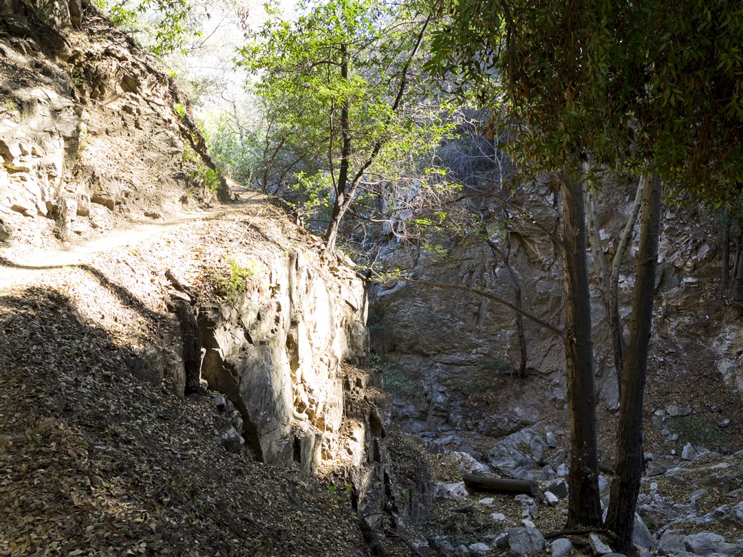
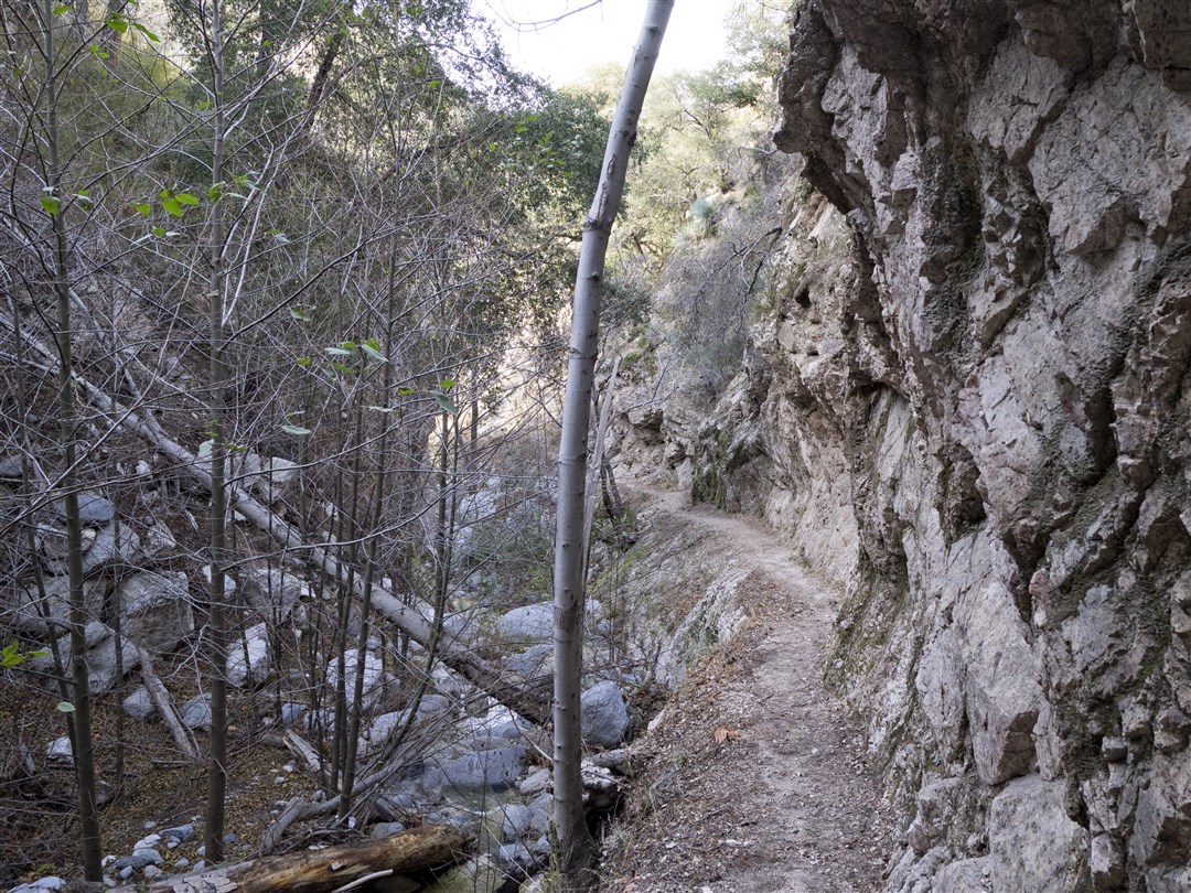
Hike #10 on Feb 15. In Angeles National Forest, from the Colby Canyon Trailhead, I hiked to Josephine Peak and Strawberry Meadow/Potrero with some friends.

Stats: 14.8 miles, 3,070′ of gain and loss. Points of Interest: Josephine Peak, Josephine Saddle, and Strawberry Meadow/Potrero Trails: Colby Canyon Trail, Josephine Saddle Trail, and Josephine Peak Road. Route description includes track map, section profile, step by step instructions, links to points of interest pages and links to photo galleries.
Hike #9 on Feb 12. In Angeles National Forest, from the San Gabriel Peak Trailhead, I hiked to Mt. Deception, Deception Plateau (unofficial name), Mt. Disappointment, and San Gabriel Peak.

Stats: 7 miles, 2,630′ of gain and loss. Points of Interest: Mt. Deception, Deception Plateau, Mt. Disappointment, and San Gabriel Peak. Trails: San Gabriel Peak Trail, Mt. Disappointment Road, Mt. Deception hiker’s trails. Route description includes track map, section profile, step by step instructions and links to photo galleries.
Hike #8 on Feb 9. In Angeles National Forest, from Chantry Flats, I hiked a loop to Mt. Zion via the Upper Falls Trail and the Upper Winter Creek Trail with Roxanne.
Stats: 9.7 miles, 1,980′ of gain and loss. Points of Interest: Sturtevant Falls, Big Santa Anita Creek, Cascade Picnic Area, Spruce Grove Campground, Sturtevant Camp, Mt. Zion Trails: Gabrieleno Trail, Upper Falls Trail, Mt. Zion Trail, Upper Winter Creek Trail. Route description includes track map, section profile, and step by step instructions.
Hike #7 on Feb 5. In Angeles National Forest, from Millard Canyon, I hiked to Saucer Branch Falls, Dawn Mine, and Echo Mountain.

Stats: 9.5 miles, 2,280′ of gain and loss. Points of Interest: Saucer Branch Falls, Dawn Mine, Echo Mountain, Sierra Saddle Picnic Area. Trails: Sunset Ridge Trail, Millard Canyon Trail, Dawn Mine Trail, Mt. Lowe Railway Trail. Route description includes track map, section profile, and step by step instructions.
Hike #6 on Feb 2. In Angeles National Forest, from Three Points, I hiked the Pacific Crest Trail to Sulphur Springs Campground.

Stats: 7 miles, 645′ of gain and loss. Points of Interest: Sulphur Springs Campground Trails: Pacific Crest Trail. Route description includes track map, section profile, and step by step instructions.
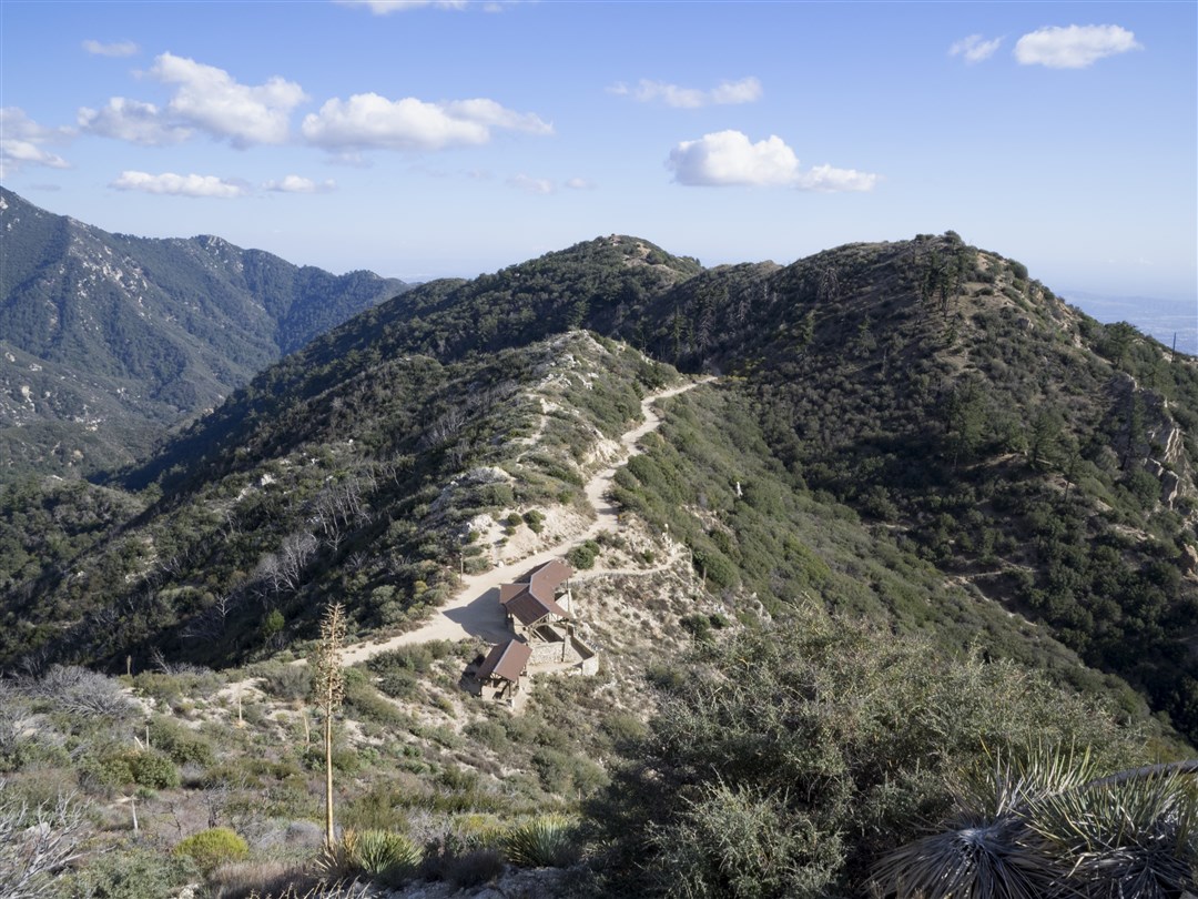
Hike #5 on Jan 29. In Angeles National Forest, from Eaton Canyon, I hiked to Mt. Lowe and Brown Mountain.

Stats: 9.1 miles, 2,520′ of gain and loss. Points of Interest: Brown Mountain, Mt. Lowe, Mueller Tunnel. Trails: Mt. Lowe Road, North Mt. Lowe Trail, Upper East Mt. Lowe Trail, Mt. Lowe Summit Trail, Upper Sam Merrill Trail, West Mt. Lowe Ridge Hiker’s Trail, Tom Sloane Saddle Trail, Brown Mountain Hiker’s Trail. Route description includes track map, section profile and step by step instructions.
Hike #4 on Jan 22. In Angeles National Forest, from Shortcut Saddle, I hiked the Silver Moccasin Trail and the Vetter Mountain Trail to Vetter Mountain.

Stats: 9.3 miles, 2,390′ of gain and loss. Points of Interest: Vetter Mountain, Charlton Flats. Trails: Silver Moccasin Trail, Vetter Mountain Trail. Route description includes track map and step by step instructions.
Hike #3 on Jan 18. In Angeles National Forest, from the Gabrieleno Trail (JPL) Trailhead, I hiked to the Debris Dam at the end of Paul Little Picnic Area and to the Oakwilde Campground Ruins.

Stats: 11.4 miles, 1,325′ of gain and loss. Points of Interest: Gould Mesa Campground, Nino Picnic Area, Paul Little Picnic Area, Debris Dam, Oakwilde Campground Ruins, the Arroyo Seco, and numerous bridges. Trails: Gabrieleno Trail and the trail through Paul Little Picnic Area leading to the dam. Route description includes track map and step by step instructions.
Hike #2 on Jan 15. In Angeles National Forest, from Switzer Picnic Area, I hiked to Bear Canyon Campground and Switzer Falls.
Stats: 7.5 miles, 1,860′ of gain and loss. Points of Interest: Switzer Falls, Bear Canyon Campground, Arroyo Seco, Bear Canyon Creek. Trails: Gabrieleno Trail, Switzer Falls Trail, Bear Canyon Trail. Route description includes track map and step by step instructions.
Hike #1 on Jan 10. In Angeles National Forest, from the Mt. Waterman Trailhead across from Buckhorn Campground, I snowshoed the Mt. Waterman Loop.

Stats: 6 miles, 1,250′ of gain and loss. Points of Interest: Mt. Waterman Trails: Mt. Waterman Road, Mt. Waterman Summit Trail, Mt. Waterman Trail. Route description includes track map, step by step instructions, and links to other photos.
