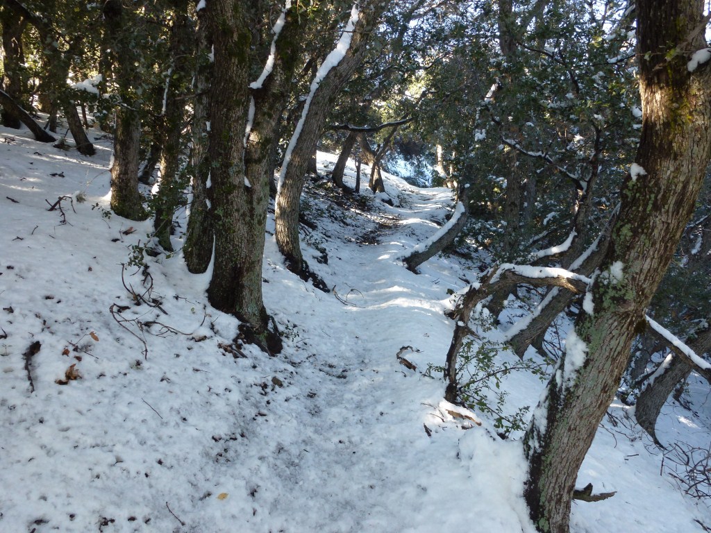
This is the second post in a series on snow hiking in Los Angeles. My first post in this series emphasized an opportunity to hike at relatively low elevations closer to the edge of the city where a recent storm is required for snow to be present and no chains or special equipment are needed.
This one goes to the opposite extreme where snow is guaranteed until sometime in spring. At 10,064 feet, Mt. Baldy is the highest point in Los Angeles County. The trailhead from Manker Flats is above 6,100 feet and can often be in snow as well. There is a ski area and restaurant up at Baldy Notch (elevation over 7,800 feet) and it’s worth taking a look at the weather conditions posted on their website (which typically includes an update on road conditions) before making the trip. Unlike treks at lower elevations, it is important to carry chains. It is also important to have microspikes, crampons and/or snowshoes as deep snow and icy conditions are common. Due to over 3,900 feet of gain on this hike, conditions can change dramatically from a thin layer of mostly slippery ice to snow knee deep or more. Therefore, I now carry both microspikes and snowshoes.
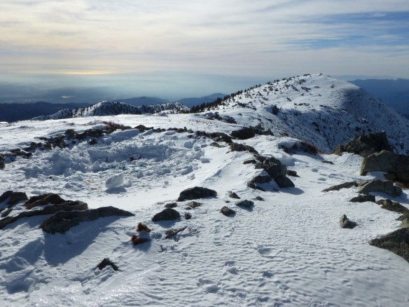
View of West Mt. Baldy from Mt. Baldy with Catalina Island in the distance.
Interestingly, both times I’ve hiked the Baldy Bowl Trail (aka The Ski Hut Trail) in the snow it was with someone I met on Mt. Baldy last summer while I was training to hike to Mt. Whitney. If I didn’t write this blog, I wouldn’t have stayed in contact with either of them.
The first hike was with Charles. At that time, I only had snowshoes and the terrain from the trailhead to the ski hut was mostly soil with patches of ice and some stretches of shallow snow and I was better off carrying my snowshoes up to the ski hut on my back pack. So, this portion of the trek was slow going and a little slippery for me. Charles had crampons and experienced no problems.
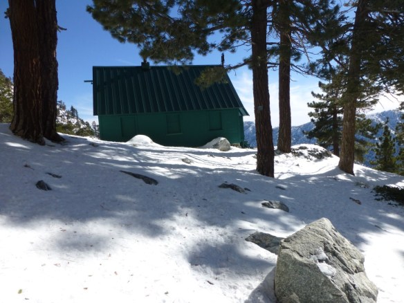
Mt. San Antonio Ski Hut
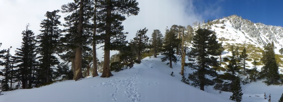
At the ski hut, it didn’t look good from a time perspective for me to make the summit. There were others there who all had crampons. One of them had an ice axe and was about to head straight up the bowl. Another had hiked the bowl in snow numerous times. It was getting late and we all had concerns about the safety of my hiking the trail without crampons as it would get more icy and slippery after the mountain began to block the sun shining on the trail. Charles could easily make the summit because his crampons would make it easy to negotiate the trail after dusk. So, Charles and I agreed that he would go on ahead while I put on my snowshoes. I would turn back after around 2:00 pm and talk to him later. After everyone else left and I had my snowshoes on, I met a couple skiers who trekked up to the ski hut (which is nowhere near the maintained ski slopes) and were eventually planning to ski down a ridge that had been very good to them in the past. At this point I realized that there were at least as many people hiking this trail in the snow as there are without it and that there is a large range of equipment used and activities pursued.
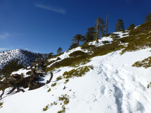
A good thing about so many people hiking this trail in snow is the trail is made clear by those who arrive early.
It was a pleasure to get my snowshoes on and start snowshoeing in deeper snow as I made my way up the trail. It turned out to be quicker for me to hike through the rocky base of the bowl in snow than it is in normal conditions as enough snow filled in the space between rocks and made a more uniform surface.
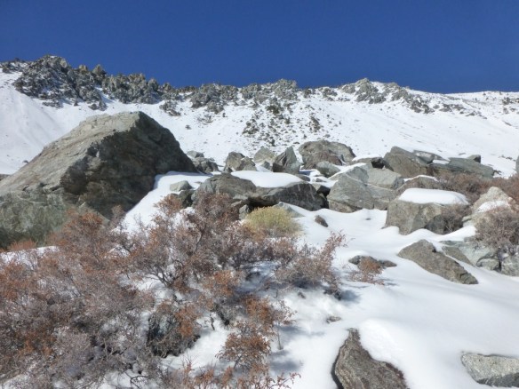
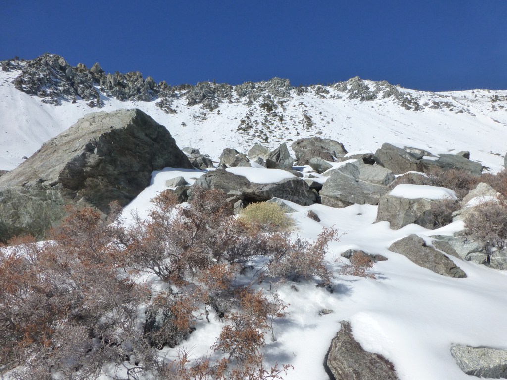
Looking up at the ridge from the base of Baldy Bowl.
After passing through the comparatively flat base of the bowl the trail gets steep and the snow became much deeper. As a result, the advantages of snowshoes on this part of the trail became apparent. My feet didn’t go as far into the deep snow and the Televators on my snowshoes which support raising my heal while keeping the snowshoe flush with the terrain made it significantly easier to handle the steeper slopes.
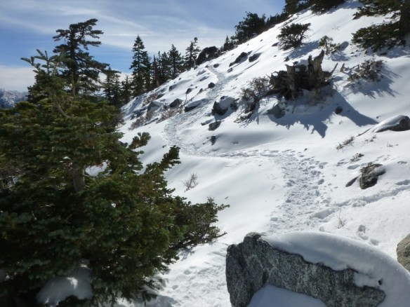
One of the steeper portions of the Baldy Bowl Trail.
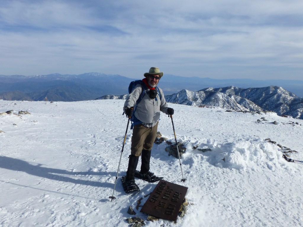
With my new found speed, it didn’t take long to pass Charles. It soon became clear that I would have a shot at making the summit after all. I caught up with another hiker named Jim and joined him for the last part of the way to the summit.
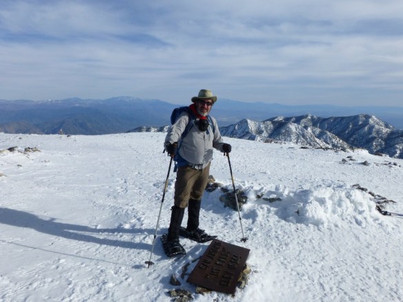
Kyle Kuns at Mt. Baldy (photo by Jim).
There were excellent views all the way down the mountain. I was once again slowed below the ski hut allowing Charles to catch up with me after he also made the summit.
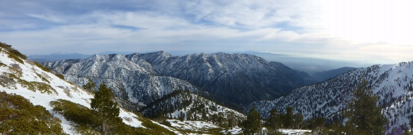
View looking down the Baldy Bowl Trail and across toward Thunder Mountain, Telegraph Peak, Timber Mountain, Cucamonga Peak, and Ontario Peak. (click to enlarge).
The next hike with Scott was significantly different and he also blogged about it. Learning from my last trek, I bought a pair of Kahtoola microspikes which worked fantastically on the lower part of the trail where there was more soil and slippery ice than snow. These are lightweight enough (and would have been very helpful on my trek to Mt. Whitney) that I’ll be bringing them on this year’s summer trip to the High Sierras. A key component of this hike was the weather. The hike began under clear skies with clouds off far in the distance below us.
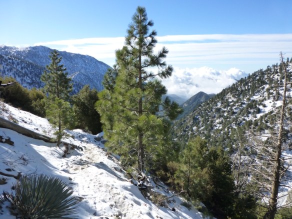
Clouds off in the distance as seen from the Baldy Bowl Trail below the ski hut.
We saw the clouds rolling in as we made our way up the mountain. After we crossed the base of the bowl and started making our way up the steeper part of the mountain, the clouds started reaching our level. The view south began to be completely blocked by incoming clouds.
Clouds rolling in along the steeper part of the Baldy Bowl Trail.
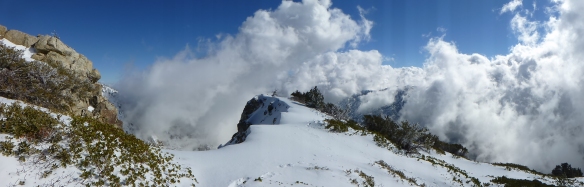
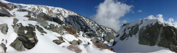
When the trail met the ridge the view was split between clouds coming up quickly from the south and clear skies to the north.
Clouds to the south, clear skies to the north along the Ridge of the Baldy Bowl Trail. (Click to enlarge)
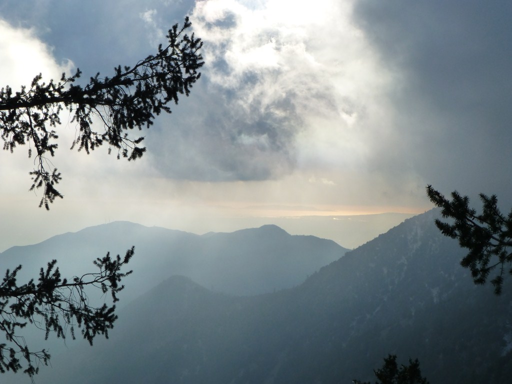
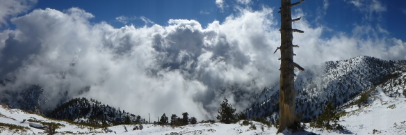
As we moved higher, the clouds continued moving in quickly and began to darken causing me to start to think about the possibility of getting caught in a snowstorm.
View south from the ridge along the Baldy Bowl Trail. (click to enlarge)
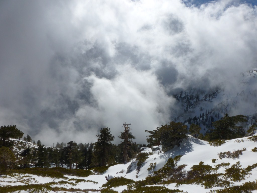
As impressive as the speed that the clouds were overtaking us was their depth. At least a few hours from the trailhead, it became unclear whether or not we could summit and make it back down the mountain before snow started. In addition, Scott was breaking in new hiking boots and it was his first time snowshoeing causing him to be more tired than on his previous summit. So, we both decided that we wanted to head back.
Tall clouds starting to overtake the higher elevations. (Click to enlarge).
The way down was filled with amazing views of fast swirling clouds. The sky was so turbulent that the scene would usually change before I could snap a photo.
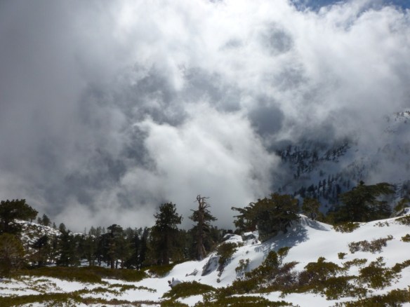
Swirling and turbulent clouds made an amazing trek down to the trailhead.
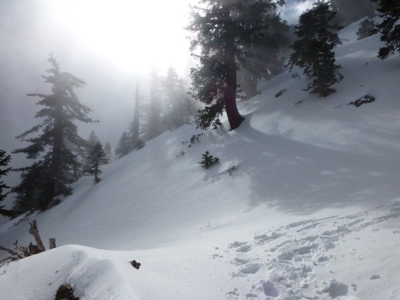
At times it felt mostly sunny with only a hint of the cloud formations.
View along the base of the bowl just above the Ski Hut. (click to enlarge)
At others we were in the mist of the clouds.
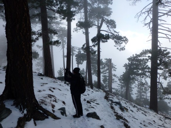
Scott Turner photographing the mist just below the Ski Hut.
Once we got below the clouds we were treated to a pretty clear view out to the ocean.
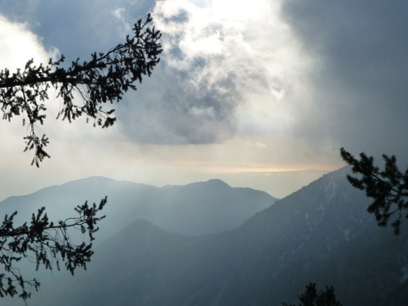
View out toward Catalina Island down near the bottom of the Baldy Bowl Trail.
I had two very different days where I thought about different challenges. Hiking in the snow can require special equipment like snow shoes to be safe. The trail looks different in the snow and will be significantly harder to follow in a storm where lack of visibility can become a serious issue and the trail can disappear with snowfall. Driving home could become a problem without chains. All this and more should be considered in determining when to turn back. The mountain will be there another day. As recently as last Sunday someone died on this mountain. This is a hard climb without snow. If you go, be careful and be willing to turn back too early rather than too late. That said, this place is amazing and I’ve taken numerous photos of the Baldy Bowl Trail these past two years on over ten assents. If you’re ready for it, it’s a must do.