I made it up the mountain for my first snowshoeing hike of the year last Friday (January 8th). Not knowing exactly what to expect, I left my house without a concrete plan of where I wanted to go. Basically, I wanted to go somewhere I had not been before in the snow. I also wanted to go somewhere lower than the places that are almost guaranteed to be in snow most of the winter (e.g. Mt. Baldy). This being an El Nino year, I expect to get out to the snow often and on this day I really wanted to snowshoe from start to finish.

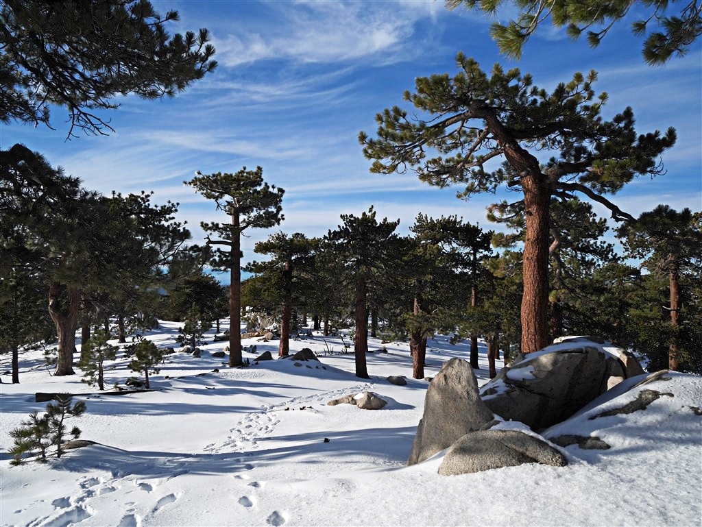
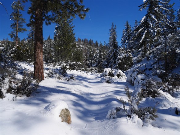
Upper Gate area of Chilao Flats. If it’s deep enough to snowshoe there, it will be deep enough all the way to the summit.
So, I headed up Angeles Crest Highway hoping something great would reveal itself and it did. As I passed the lower entrance to Chilao Flats, I noticed the gate was open. This got me thinking about going to Mt. Hillyer. When I drove past the upper entrance, it was clear that the snow was deep enough to snowshoe from Angeles Crest Highway. Although the upper gate was also open, the road wasn’t plowed and it probably was not driveable without snow tires or chains. As a result, I doubled back a bit and parked in one of the plowed areas off Angeles Crest Highway between Devil’s Canyon (not plowed) and the upper gate.
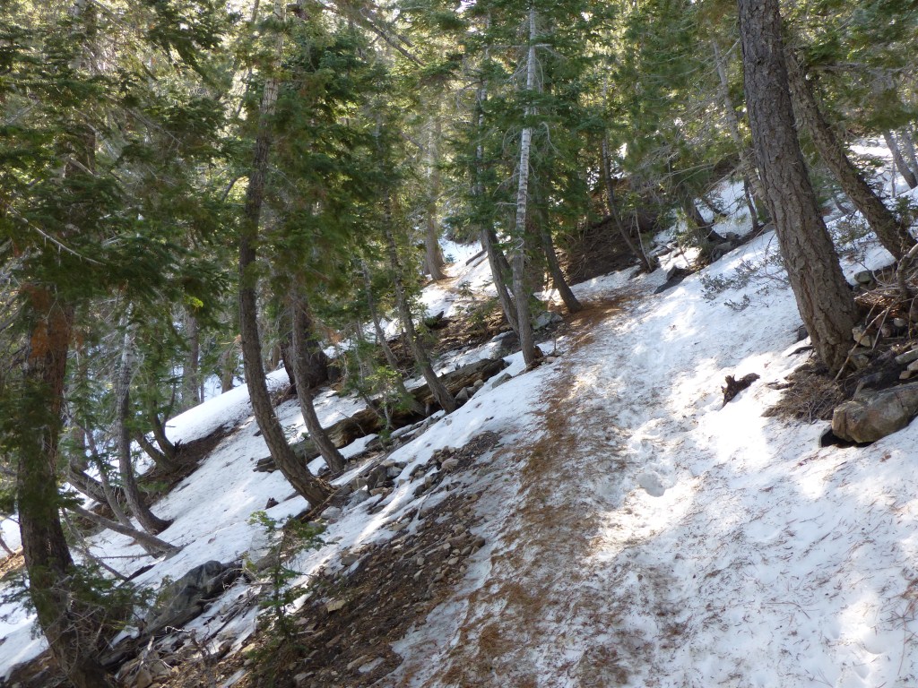
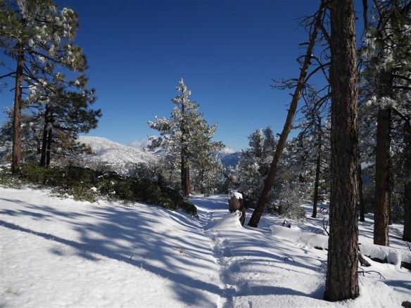
First one up the Silver Moccasin Trail, I enjoyed making my way through the fresh powdery snow.
Although a couple other people also were snowshoeing the road down to the trailhead, I was fortunate enough to be the first person to head up the Silver Moccasin Trail toward Horse Flats. Normally, numerous people beat me to the trailhead and I have their tracks to follow. Since I only hike areas in the snow that I’ve hiked several times before, I had the confidence to proceed knowing I wouldn’t get off trail (or at least not too far off trail). It’s also true that this area is much flatter and comprised of more rolling type hills than most other areas in the forest. Therefore, even if I ended up off the trail I could have a great day wandering around and find my way back by retracing the footsteps I was creating in the fairly deep snow. So, I thoroughly enjoyed the crisp sound of creating fresh footprints and the pristine visual of undisturbed snow.

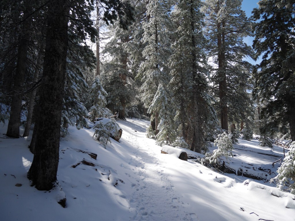
One of the narrower parts of the trail. Note the vegetation that serves as somewhat of a guardrail.
This is a great area to visit in the snow because the terrain is comparatively flat for the San Gabriel Mountains, it is reasonably wide in most places (so you can snowshoe effectively and if you fall it won’t be down the side of a mountain), and is fairly well protected when narrow. I forgot my trekking poles and ended up falling a few times when my snowshoes got tangled up (it’s amazing how subconscious fixing that situation without falling has become for me when I have my poles). As a result, this is also a significantly safer area to traipse through the snow than the narrower trails with steep drop-offs to at least one side.
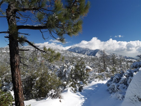
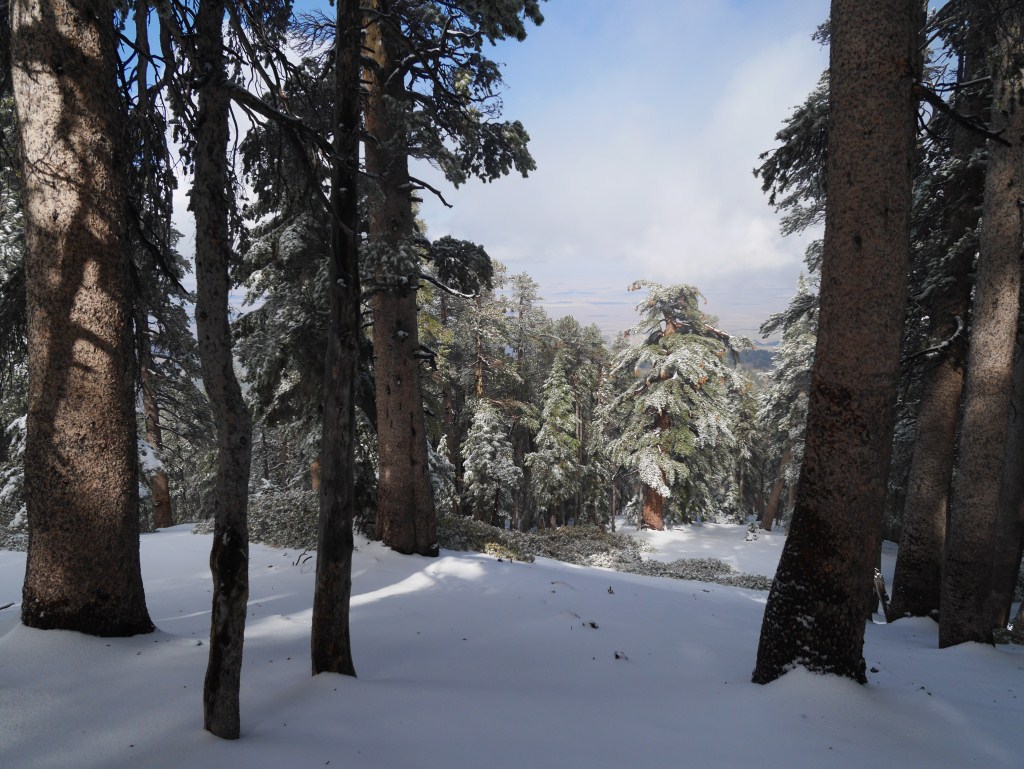
An expansive view from the Mt. Hillyer Trail looking toward Mt. Waterman and Twin Peaks. That I could look back and see each of my footprints defined in the snow instead of a rugged long depression recording multiple journeys by others before me made stepping in the undisturbed snow feel even more special.
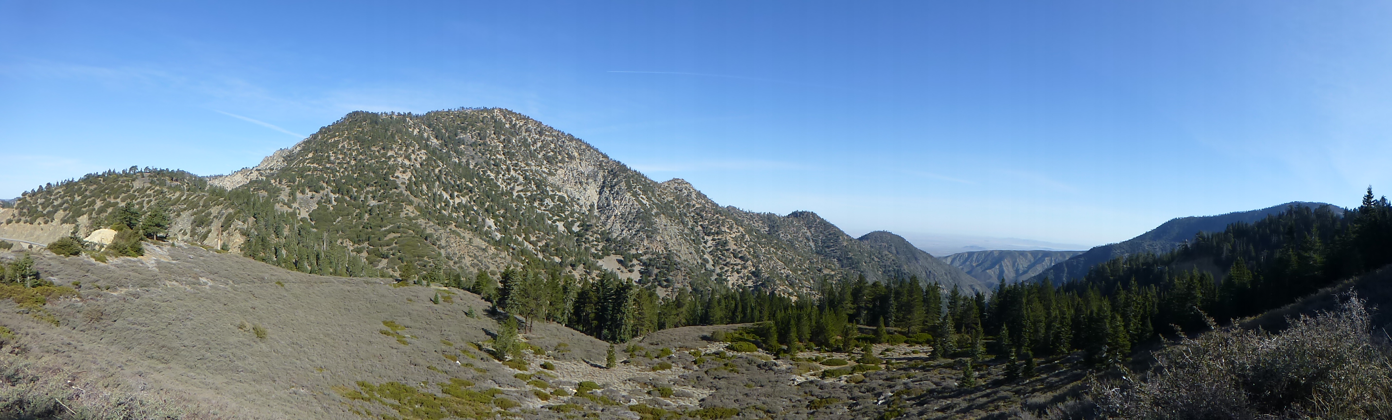
The Mt. Hillyer Trail between Horse Flats and Mt. Hillyer is among my favorites in the forest. I like the expansive views across long distances to peaks in all directions.

The prevalence of partial snow covered large boulders, snowy trees, and constantly changing great views make this trail continuously inspiring all the way to the summit.
I find the seemingly endless outcrops of boulders to be magnificent. In snow, the varying degree to which the boulders become snow covered and emphasize the color of the rock combined with the melting water lines (and sometimes icy stalactites hanging down) create a natural sculptural garden of immense beauty. It feels as though each turn in the trail yields something new and beautiful to behold. To provide a sense of scale, the boulders are large enough that mountaineers (I’m not sure of what level) come here to practice rock climbing. I’ve been on the trail at times where I saw more people climbing rocks than hiking.
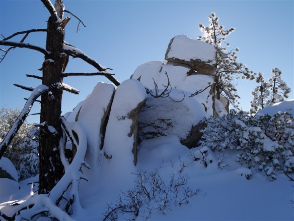
One of my favorite outcrops which helped guide me up the mountain in the snow. There is a great ledge with a magnificent view on the other side that is fun to climb up to (even for a non-mountaineer like myself) when it’s dry.
I should point out that previous knowledge of the various boulder outcrops (the one pictured above being one of my favorite places in the forest) helped guide me up the mountain to my intended destination. I’m not sure how I would have done without that prior knowledge. Although I think I would have made it anyway, I also believe anyone journeying up this part of the trail would have a great time even if the peak wasn’t reached.
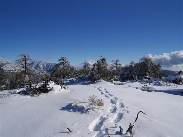
View from Mt. Hillyer.
As much as I love the trail to the summit, I’m the first to admit the peak itself is a bit of a disappointment–especially when compared with most other peaks in the range. For myself, however, snow manages to improve the experience significantly because the surrounding views stand out more due to contrast provided by the temporary whiteness, tracks in the snow add some nice texture to the fire charred and somewhat barren peak, and the vegetation that rises above the ground pops against the whiteness instead of blending into the dirt. As a result, the snow cover yields a meaningfully less cluttered look than the somewhat clumpy dry landscape filled with a prevalence of scattered burnt tree branches that normally provides groundcover in this burn area.
One of the long views across one of the flatter portions of the Mt. Hillyer Trail.
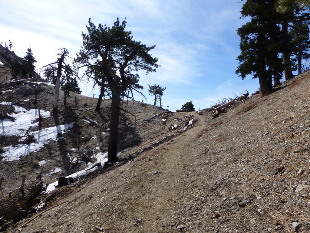
As I made my way back down the trail, I enjoyed the intermixing of flat parts, mildly graded parts, somewhat steep parts (but not steep enough to require me to use elevators on my snowshoes on the way up), parts with boulder formations, parts without and so on. For such a short trail between Horse Flats and Mt. Hillyer, I found the almost checkerboard degree of variation–especially in snow–to be so stimulating I was almost disappointed to make it down the mountain.

The Silver Moccasin Trail in the late afternoon showing the record of trips made by others during the day. Without snow, I wouldn’t have known anyone else was on this part of the trail on this day.
Until about half way down the Mt. Hillyer Trail, mine were still the only footsteps I saw (except for wildlife). When I did see others (a few humans and a dog–perhaps just one small group), the snow still remained deep enough throughout to enjoy snowshoeing. When I made it back down to the Silver Moccasin Trail, the beginnings of a long rugged depression recording the journey of many others had formed. In a few spots (perhaps 5 steps at a time), the combination of south facing terrain and enough people walking on the trail yielded a depression deep enough to reach dirt. Aside from 20 to 25 steps overall at the end of the day, I was really happy to be wearing my snowshoes throughout.
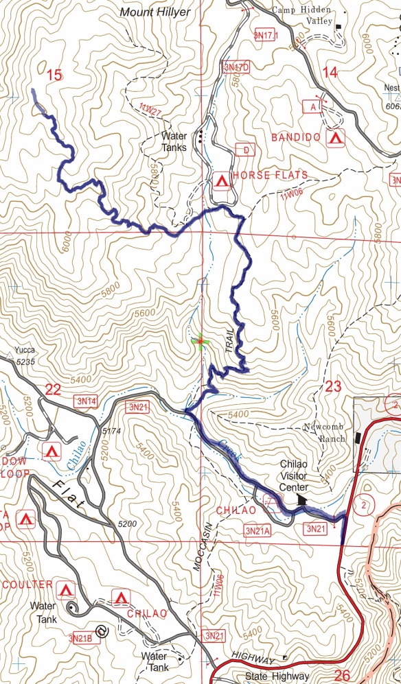
Track map from Angeles Crest Highway to Mt. Hillyer using Backcountry Navigator (US Forest Service-2013 map) from my phone.
Follow this link for step by step instructions from the obvious trailhead found by following the road down as shown on the map above. Follow the links below for additional photos: