The range of experiences I had during my four day backpacking trip through the Grand Canyon were remarkable in their breadth and intensity. I ended up taking over a thousand photos which took a while to go through. Since I’m a visual learner, finding the words to express what I saw was challenging and required time to surface. While breaking out the thesaurus was helpful, I really could have used some time consulting with Shakespeare to invent new words. What follows is merely a sampling of what stood out most during my journey. I found the Grand Canyon to be:
Vast

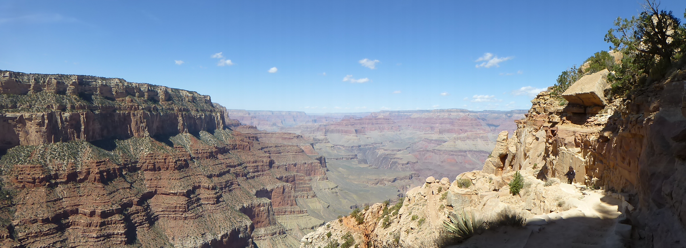
Vastness as seen along the South Kaibab Trail near the South Rim (Click to Enlarge)
Being at the South Rim (or close to it) is where I most felt the vastness of the Grand Canyon. The general overall form is viewable but specific features are mostly too far away to be perceivable. Off in the distance, the North Rim appeared to be the same as what I was experiencing on the South Rim. This deceptive uniformity is a key element to generating the feeling of vastness as there isn’t much to focus on except the space between the massive rock walls which define the canyon’s boundaries. The uniformity of the horizontal banding along with consistent changes in color and slope of the rock walls made its vastness more realizable for me. Those encompassing characteristics allowed me to get a sense of the distances by noticing how much smaller the horizontal layering looked across the canyon compared to where I was standing. Clues to what exists beyond the view of the rim also served to enhance the sense of vastness of the canyon. For example, the comparatively smaller gorge that the Colorado River still runs through is visible from the rim but the river itself isn’t. Unexpectedly, I later found the depth of the canyon far more impressive from vantage points below.
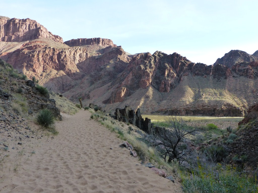
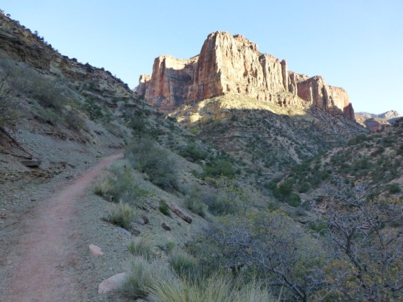
Dramatic
The South Kaibab Trail
Descending the South Kaibab Trail was a dramatic experience for me in part because the scale of the landscape was so phenomenal that each huge element within it had enough space around it to reveal its individual splendor. Even the trail itself continually displayed its magnificence as it usually cuts through the landscape in a way that reveals long sections of it at a time. Whether I was hiking around a butte, down the side of a cliff, or across a plateau; each new section provided an engrossing new perspective. As vistas continually opened up or became hidden, it felt like watching a captivating movie with lots of twists and surprises in the plot. While trying to absorb the spot I was currently in, anticipation of what it would be like to stand along the next section of trail already visible down or across the landscape would compel me forward.
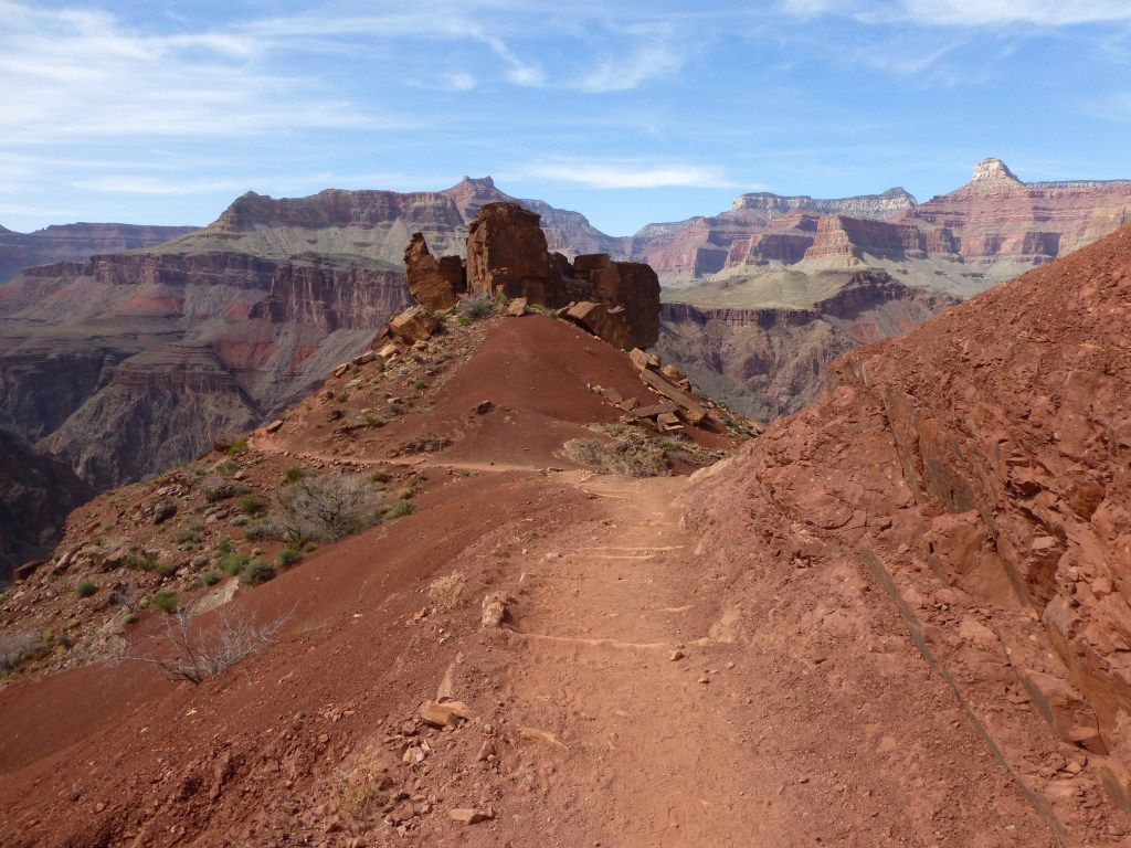
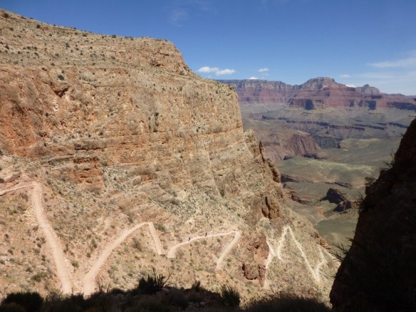
Expansive
Expansive view from the South Kaibab Trail near the Tonto Platform. (click to enlarge)
At around the depth of the Tonto Platform, the Grand Canyon appeared more expansive than vast to me. The dominant view across to the North Rim no longer appeared uniform because I was now close enough to see individual elements clearly across the gorge. Rather than blending into the landscape, many of the buttes now stood out and provided the necessary discreet forms to make distance more tangible and the perception of space more comprehensible. The almost blurry uniformity seen from the South Rim was now replaced with a crisp multifaceted skyline created by this new vantage point simultaneously being below many of the landscape’s features and yet far enough away from them to see them fully. The immense size of the plateau made walking through it an expansive experience because of the new perspectives that were generated by moving past huge features thereby opening up more distant vistas to behold.
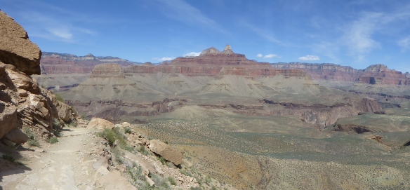
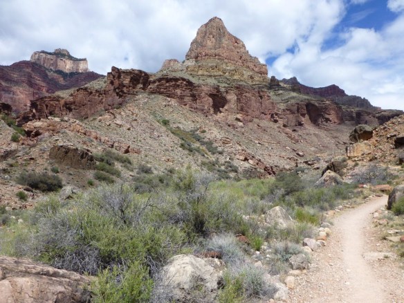
Grand
The Grandeur of the South Kaibab Trail as seen just below the Tonto Platform. (click to enlarge)
I experienced the grandeur of the canyon mostly at the edge of the Tonto Platform or just below it. This is where the Colorado River and one of the rims can be seen at the same time, which is not possible up at the rim or down by the river due to the proportions of the gorge. Also in view at the same time are the full height of the massive cliffs that define the gorge, the Tonto Platform across the gorge, numerous large buttes, and often a large section of trail. I found the confluence of all these prodigious elements in one view to be magnificently grand.
Subtle

View of the same rock outcropping as seen in the photo above. from another angle.
By the time I’d hiked down a few miles and saw yet another slightly different scene I remember thinking to myself; “wow, this place is subtle.” For me, this was possibly the most unexpected and inspiring aspect of the Grand Canyon. It just seemed that every turn yielded something different. While it’s true that some of the differences were of the dramatic and breathtaking variety, the majority of them were small. This kept the experience of hiking throughout my four days phenomenally fresh. Even on the last day when Scott and I hiked close to 17 miles and 4,300 feet of gain and I was extremely tired physically; I was never bored or remotely disinterested. Frankly, I think the constant subtle changes with every turn helped pull me out of the canyon as my anticipation to discover what I would see next gave me that extra boost of energy I needed. Within the immense context of the Grand Canyon that was almost always in view to some degree, there was somehow always something fresh to latch onto in the foreground—a change in vegetation, a new form, a new perspective of an interesting form, another texture, a change in the composition of rock, a difference in the grade, composition, or orientation of the trail, a change in the sense of space. The list is endless. I think I found these changes to be subtle because they were always in juxtaposition and even competition with the larger context that dominated the view.
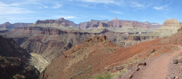
Ancient
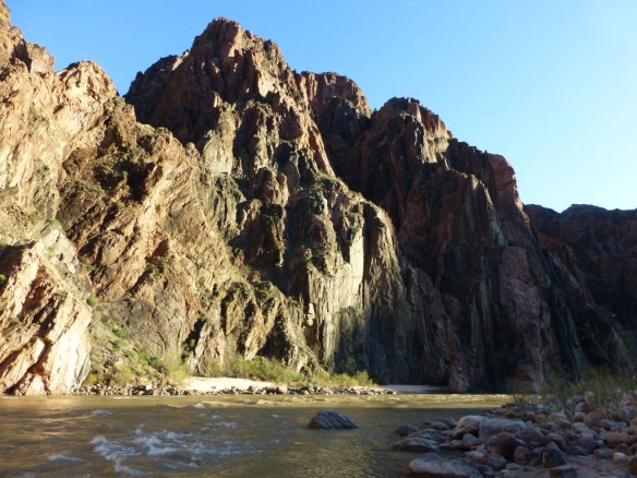
View of the Colorado River with large rock sticking out of it and similar shaped point on top of the canyon wall beyond.
Although I hadn’t really studied the canyon’s geology, I at least knew that erosion by water and wind over millions of years played a huge part in generating what we currently see. Hiking down the South Kaibab Trail, I internalized that ancient history visually, kinesthetically, and auditorially (it was very windy that day). While sitting along the bank of the Colorado River near Bright Angel Campground, I thought about how many of the key processes that formed the Grand Canyon are still going on today. As I watched and listened to the river swiftly flow past me, I started focusing on a large rock protruding out of the water. Soon, my attention wandered along the canyon walls beyond and I noticed a loosely similar pointy shape. It wasn’t too much of a stretch to imagine back to a time when that pointy shape stuck out of water and looked similar to the rock I’d been focused on for a while. Of course the water wouldn’t have been as deep as the canyon walls because the ground level of the canyon would have been higher back then. During the rest of my trip I would frequently look out and imagine a higher canyon floor and picture the buttes poking out of water instead of towering over the landscape. Although these imaginings were at best broad brush stroke generalizations, they still added a dimension to what I saw and caused me to pause more often and take in the scenery more deliberately. This was especially vivid when what I was looking at included a view across the canyon toward one of the rims because the banding described above allowed me to imagine a canyon floor across a huge expanse of space.
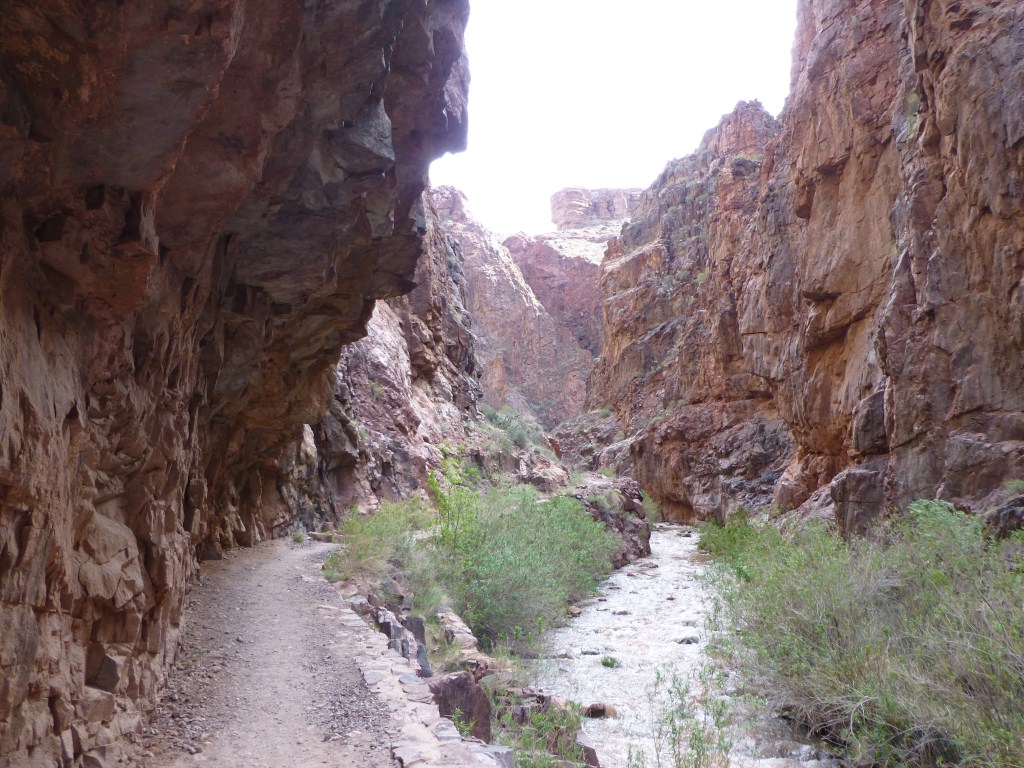
Enclosing
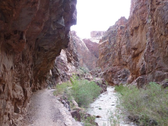
Enclosing nature of “The Box” area along the North Kaibab Trail.
It didn’t take long hiking up the North Kaibab Trail to know that the trail up the north side of the canyon was going to be meaningfully different. Not far from Cottonwood Campground the trail meanders through an area called “The Box” that I felt was interestingly enclosing. In this area the trail is bounded on each side by high walls which are separated from each other by a narrow space. The trail constantly curves in a way that rarely yields a long view. Typically, from anywhere I stood I was completely surrounded by massive walls. Even making it out of the box where the view opened up considerably, it never opened up to be anywhere near as expansive as the South Kaibab Trail.
Sculptural
The sculptural nature of the landscape as seen along the North Kaibab Trail below Cottonwood Campground.
The multiplicity of individually distinct forms created by wind and water erosion produced a remarkable sculptural quality to the landscape. These natural sculptures (more technically referred to as buttes, cliffs, or rock outcroppings) were compelling for me to behold as I made my way around them. One after another they would appear and their usually asymmetric shapes would be revealed in dramatic fashion as I made my way around them. Typically massive in size, I found myself photographing the same structure several times as my ability to discern its shape changed as I reached places to see it from different perspectives. The phenomenal amount of subtle changes in slope, height, length, width, texture, color, and juxtaposition with other forms provided a never ending display of fascinating compositions. Anyone interested in the production of form would be awestruck.
Monumental
A monumental form along the North Kaibab Trail heading up Roaring Springs Canyon.
A subset of the sculptures mentioned above should really be classified as monumental as they possess a greater degree of appearing monolithic due to standing out somewhat architecturally in the landscape as a dominant individual form. Their size (though still massive) is such that they feel as though they could be old castles, cathedrals, or walled towns. This makes them more tangible and oddly humanizes the areas where they exist making it easier to internalize the scale of the immense spaces they inhabit.
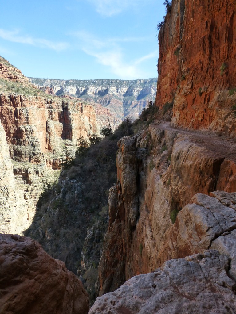
Stupendous

View down the North Kaibab Trail.
The North Kaibab Trail as it makes its way through Roaring Springs Canyon displays the stupendous nature of the place. The long view which is typically visible only goes out as far as another portion of the South Rim. Most anywhere else that would be a remarkable long view. However, in the Grand Canyon it feels truncated compared to the more vast and expansive views of the South Kaibab Trail. At the same time it’s never enclosing like the trail when it meanders through The Box. Here is where verticality is felt most keenly. The canyon walls tower above, and the trail clings to their side at times overlooking drops of several hundred feet (or more) to a canyon bottom often too far down to be in view. The width of Roaring Springs Canyon is such that the walls across the way are far enough away to perceive their full height and close enough to feel their presence and discern their subtlety. Everything feels giant and impressive. As if that isn’t enough, a forest emerges. Impressive trees look small when viewed just tens of feet away and the larger walls are also in view.
Diverse
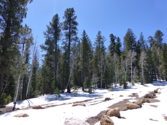
The North Rim
By the time I found myself on the North Rim, in snow, and in a forest I found myself in awe of the diversity of experiences I had (which only increased as I later made my way up the Bright Angel Trail). I’ve written about how interesting it is to go on hikes with significant elevation gain in the past. So, I expected to see differences. However, the Grand Canyon produces diversity to an incredible degree as there is so much more going on than changes in height and orientation produce. Phenomenal changes in the spacial and geomorphic quality of the landscape produce unexpectedly different conditions that foster remarkably diverse responses to them.
Kinesthetic
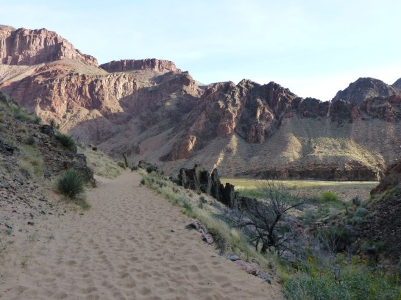
Sand on the Bright Angel Trail near the Colorado River.
I really felt that I was internalizing part of what the Grand Canyon is about kinesthetically as I hiked my way through it. I knew it was going to be strenuous as Scott shared with me the fact that he was questioned during the permit process to make sure we knew what we were getting into (which you can’t really until you do it). There were times where I just felt that the canyon was talking to me through my body. It was more than just being strenuous. There just seemed to be a coincidence of timing to make a particular aspect of the canyon more poignant. Having the trail turn to sand 7 miles into the last day’s journey is a good example of what I mean. I was already pretty tired from the previous day’s hikes. While crossing the Silver Bridge I was psyching myself up for the pending gain of about 4,300 feet only to arrive at the other side and reach sand that was deep enough to add a level of difficulty to traverse. I was as if the Grand Canyon was saying to me that I was now tired enough to feel throughout my entire body the qualitative differences between walking on sand and a harder surface. Interestingly, this also made the ascent up the canyon a little easier mentally as I told myself several times “at least I’m not walking in sand.”
Intimate
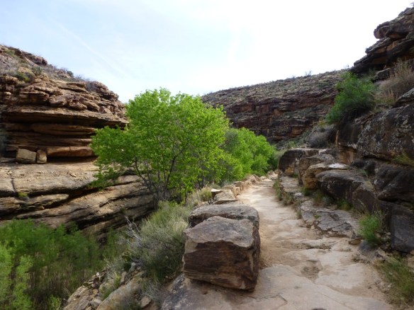
Intimate stretch along the Bright Angel Trail below Indian Gardens.
Parts of the trail are unexpectedly close to human scale. While the proportions of the details of the individual components of the landscape always remain colossal (e.g. the thickness of layers making up a rock wall), there are areas where the experience of traversing the trail feels intimate. The space in these areas feels like walking on a street next to 2-4 story buildings. Views out are blocked so any sense of horizontal expansiveness is hidden. The walls are just high enough to block the view of what is beyond above and below so that one’s field of vision is limited to distances of hundreds of feet instead of miles. Especially when there are additional features like trees and water and/or a small difference of level between the trail and the bottom of the viewable canyon a sense of intimacy was my dominant feeling. On my fourth day after experiencing the incredible range of wondrously large and expansive spaces, the intimacy of the Bright Angel Trail just before reaching Indian Gardens was oddly breathtaking. Among the many incredible things about the Grand Canyon is that it can be simultaneously intimate and breathtaking.
It Is Also Much More Than That
There really is so much more to share. However, it doesn’t make sense to me to do so in the scope of a blog post. This one is already incredibly long. The Grand Canyon is truly a phenomenal place worthy of being referred to as one of the “Wonders of the Natural World.” I will return to it one day and share more in the future. Until then, I offer many other photos for you to look through should you desire more now.
Photos of the South Kaibab Trail.
Photos of the North Kaibab Trail from Bright Angel CG to Cottonwood CG.
Photos of the North Kaibab Trail from Cottonwood CG to the North Rim.
Photos of the Bright Angel Trail
Photos of Ribbon Falls