
Last year I had to turn back at Anderson Flat long before reaching my goal of summiting Mt. San Gorgonio due to my inability to find water. Disappointed as I was, it was clearly the right choice not to summit. I photographed my last look at the peak from that trip while thinking about returning someday to reach the summit.

Last view of Mt. San Gorgonio in August 2012 (East San Bernardino Peak to the left)
I returned on Monday. When I started up the Vivian Creek Trail I had no intention of spending the night on the summit. My plan was to spend the night at Dry Lake View Camp after summiting. However, my progress up the mountain was slower than anticipated in part due to weighing down my pack with lots of extra water from High Creek Camp (I didn’t want a repeat of last year). By the time I had a clear view of the peak and a sense of how much further I needed to go, I knew I would be chasing light to both summit and make it to my planned destination.

View of Mt. San Gorgonio from the Vivian Creek Trail–Jepson Peak on the left. (click to enlarge).
My prior experience in the San Gorgonio Wilderness had me concerned that I might pass the campground without noticing it as the campgrounds aren’t always clearly delineated and campground signage (that I’ve seen so far) is subtle if it even exists. I started thinking about last year’s experience and whether or not I should risk trying to locate Dry Lake View if I couldn’t reach it before dark. It was at this point that I starting considering spending the night on the summit.

Approach to the summit as viewed from the campsite I eventually chose to spend the night. (click to enlarge)
I reached the junction where I needed to decide whether or not to summit early enough that is was still possible that I could both summit and make it down to the campground. The weather conditions were excellent. I was still warm enough to be in short sleeves, the sky was mostly clear, and there was very little wind. Being so close to the summit, I didn’t want to miss it a second year in a row, so I headed up. On my way I started seeing numerous clearly defined and level campsites with wind breaks made of rock.

View looking at my campsite –notice my shaped tarp on the right. (Click to enlarge).
While I was exploring the summit and seeing so many great campsites, the thought of rushing down to try and make it to another campground before dark was unappealing. So, I decided to set up camp.
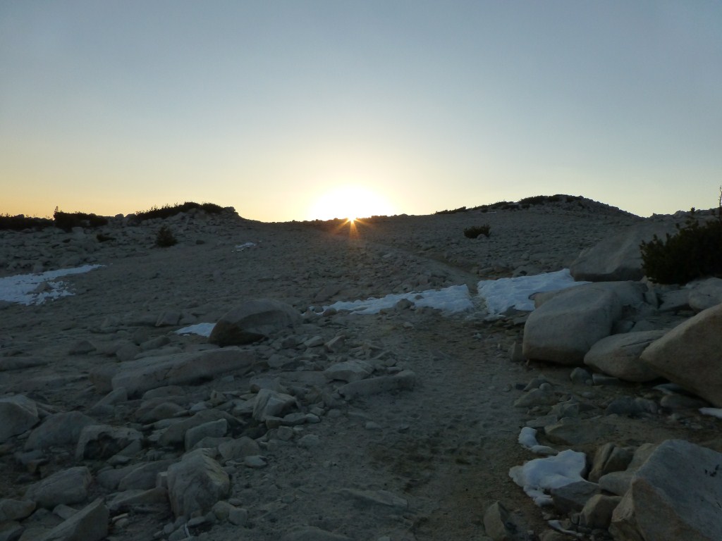
View looking back toward my campsite (between bumps) on Mt. San Gorgonio.
No longer in a rush, I savored the rest of the night on the summit walking around and watching the changing light as the sun went down. I found several vantage points to watch it disappear from view.
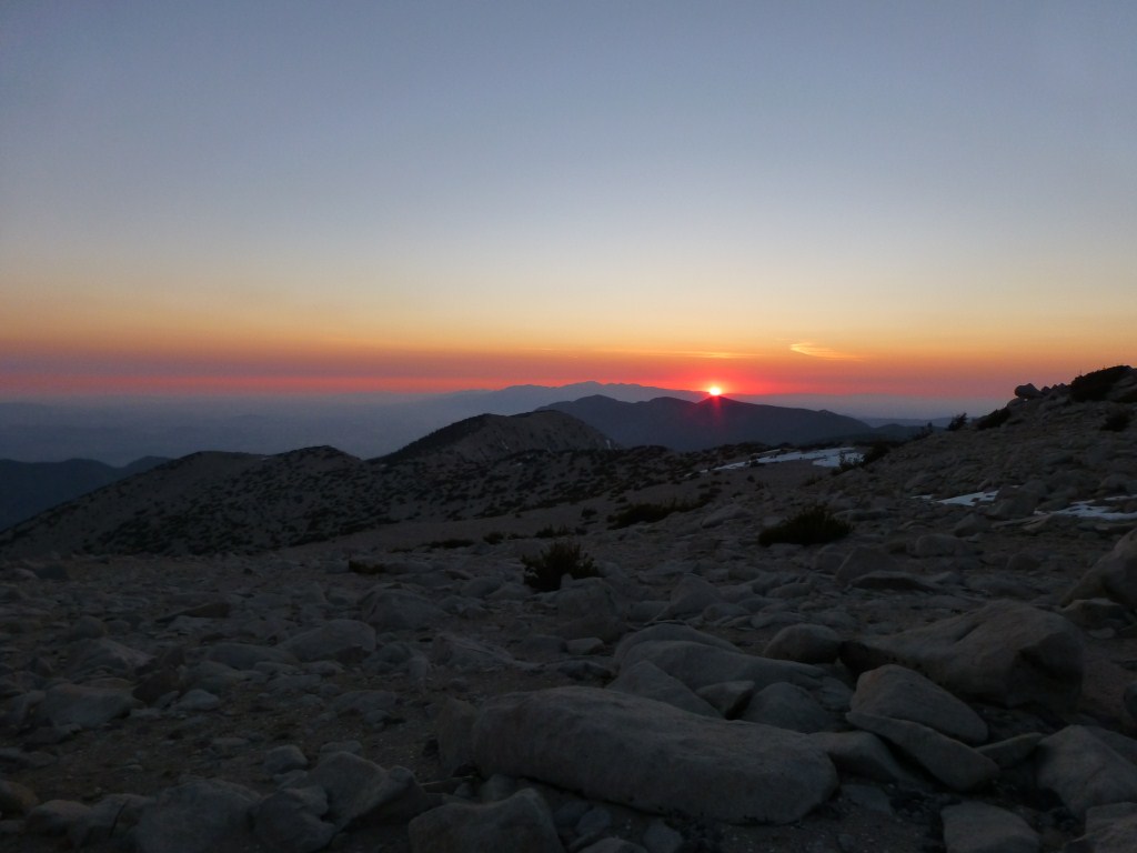
Sunset from in front of the bump on Mt. San Gorgonio where I ate dinner.
I found a spot with a great view of the sunset where I ate my dinner and enjoyed watching the lights come on in the city below.

Night view from the summit.
The rest of the night I enjoyed looking up at the stars and down at the city lights from a variety of spots.
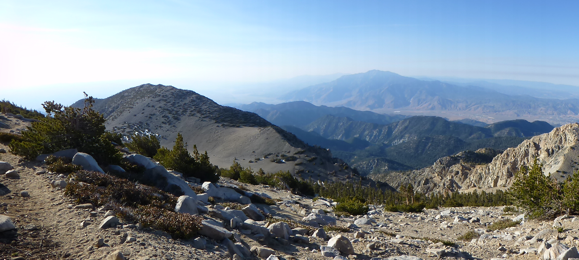
View toward Mt. San Jacinto from the Sky High Trail (click to enlarge)
The following day I continued my traverse of Mt. San Gorgonio by heading down the Sky High Trail where the views were breathtaking.
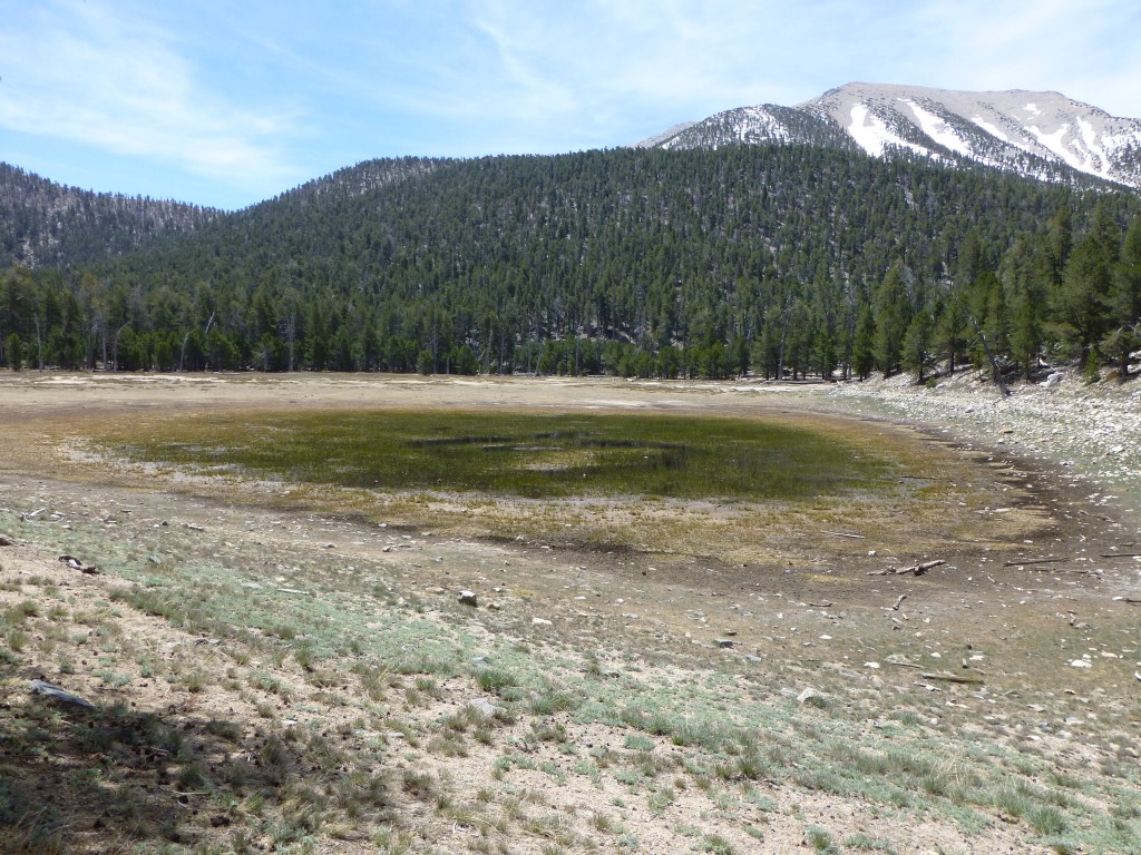
View of Dry Lake with Mt. San Gorgonio in the background.
I met my friend Scott at Dry Lake.We hiked down the Dry Lake Trail and then the South Fork Trail and Scott drove me back to my car at the Vivian Creek Trailhead on the other side of the mountain.
Photos of the Vivian Creek Trail

Awesome hike and camp spot! Great photos.
LikeLike
Thanks.
LikeLike
I just hiked Mt San Jacinto a few days ago, and Mt. San G is next on my list. Thanks for the great write-up and pics!
LikeLike
You’re welcome. Mt. San Jacinto is one of my favorites. I’m going there soon as well (provided I can get a permit …).
LikeLike
Nice writeup Kyle, and great pics as usual. So funny, on May 18th I was on Momyer Creek Trail near Saxton Camp – scoping out some sites for a Memorial Day weekend trip up there with my wife via Momyer to the summit. I was within 2 miles of Dollar Lake Saddle. We are debating doing the peak with full packs or just dropping them at camp and using a daypack.
LikeLike
I haven’t hiked up the Momyer Creek Trail yet. What’s it like in comparison to Vivian Creek? Any water at Saxton Camp?
LikeLike
Momyer isn’t as steep and as maintained as Vivian, but more secluded. At times the path is cut out of some serious talus with long drops. First couple of miles is mostly exposed and then plenty of shade. Lots of water at Alger Creek, Dobbs and a creek about 500 yds before Saxton.
LikeLike
Thanks for the overview!
LikeLike
Great job and congrats, Kyle. I love your stuff.
LikeLike
Thanks Jim.
LikeLike
Great post. Love the pictures. I really want to camp up there now.
LikeLike
Thanks Scott. I wouldn’t have done it if you weren’t planning to go to Dry Lake the following day. If I can’t join you when you camp there, perhaps I can return the favor so you can also do a traverse.
LikeLike
beautiful view!
LikeLike
Thanks
LikeLike
Nice work Kyle. I have always wanted to spend the night on top of Gorgonio – and schedule it for a meteor shower. I have summited many times, but never with a full pack. Always left my pack at High Creek and went with a daypack. This is a hard slog with a full pack!
My plan was to go early in the year when there is still snow on the north side which I could melt for water, eliminating carrying it. Did you still see suitable snow now?
LikeLike
Thanks Norbert. I filled up 6 liters at High Creek to get me through the night and down to Dry Lake. I actually didn’t need to add more at Dry Lake, so I think I could have gotten away with 5 liters. After last year though, I’d rather play it safe when it comes to water.
There were several spots with snow on the High Sky Trail between the summit and Mine Shaft Saddle. See this set of pics (http://wp.me/P2euvb-1R9) for examples. Some of it would be suitable but you’d still need to carry it a large portion of the way up as there is virtually no snow at the summit or the south facing portion of the High Sky Trail. Perhaps you would have better luck with the Dollar Lake approach as there looked like there was a fair amount of snow from afar (but that’s just conjecture).
LikeLike
Beautiful location. Thanks for the write up 🙂
LikeLike
Thanks, it’s among the best in Southern CA.
LikeLike