Hiking in 2015 began for me with a camping trip to the Anza-Borrego Desert with my friend Scott. I’ve had going there on my bucket list since I met a hiker a few years ago near Mt. Wilson who gave me an impassioned description of its magnificence. The area this desert encompasses is so vast with so much to see that I found choosing a place to go overwhelming. Thankfully, Scott is in the process of hiking all the trips covered in Afoot & Afield: San Diego County which allowed me the opportunity to simply tag along on a couple hikes he hadn’t yet done. I chose to have this trip be about simply getting a glimpse or the desert with the understanding that I plan to go back several times to garner anything resembling an introduction. My glimpse turned out to be engrossing and I hope to return a couple times this year before it gets too hot for me.

View from an unnamed peak with Smoke Trees Canyon visible on the left. Dry teddy-bear cholla cactus and ocotillo stand out in the landscape.
Although I went on three hikes on the trip,1 I want to share a brief look of my most tangible first impression through the lens of parts of just one of them–mainly Smoke Tree Canyon. In the areas I visited, my main impression was that there is an extreme duality that every part of the landscape displays in relation to water. I expected the dry part. From a distance, adjectives like barren, desolate, and stark ring true. I hadn’t really thought that much about how intense the wet part could be nor how it would show up in the landscape.

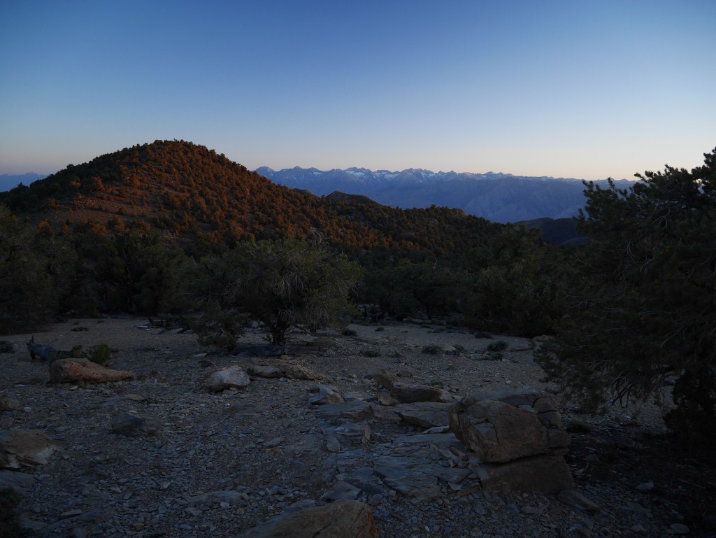
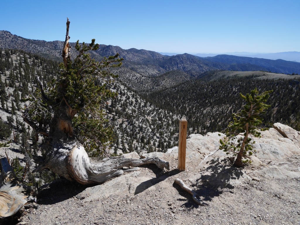
View from the unnamed peak looking across Smoke Trees Canyon to the mountains beyond.
By the time I found myself enjoying the view from an unnamed peak, I had been thinking about the presence/absence relationship the landscape had with water for a while. While contemplating the rocky ground I was standing on, devoid of almost anything that could be considered dirt as most of that must get washed down the mountain sides in the rain; I looked out toward the mountains and noticed the high walls of Smoke Trees Canyon characterized by heavy erosion scarred cliffs terminating the mountain slopes.

View up Smoke Trees Canyon from an unnamed peak.
I turned my attention further up the canyon thinking about the awesome impact water must have moving down these mountains in the rain. With no meaningful vegetation to slow water down or soak it up, the volume of water and speed by which it travels through the canyon must at times be phenomenal. I began wondering how little rain is actually needed to produce a flash flood. The scale of the area producing drainage is so vast.
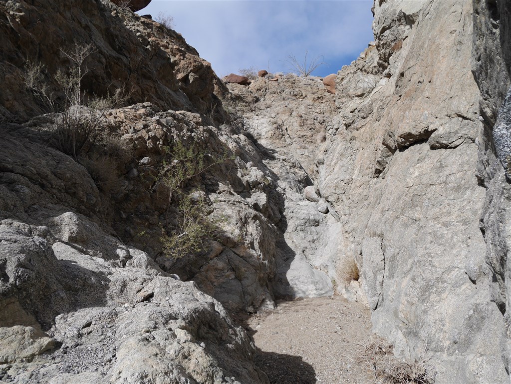
Looking back at a dry waterfall that we needed to scramble down enclosed by rock canyon walls.
Reaching the canyon floor, long expansive views gave way to tall enclosing walls. The ground being sandy as opposed to the rocky ground leading down the mountain side, it was clear that I was walking down a temporarily dry stream bed. My earlier bird’s eye view from the peak wasn’t required to see the absence of a potentially fast moving and deep body of water flowing through this area.
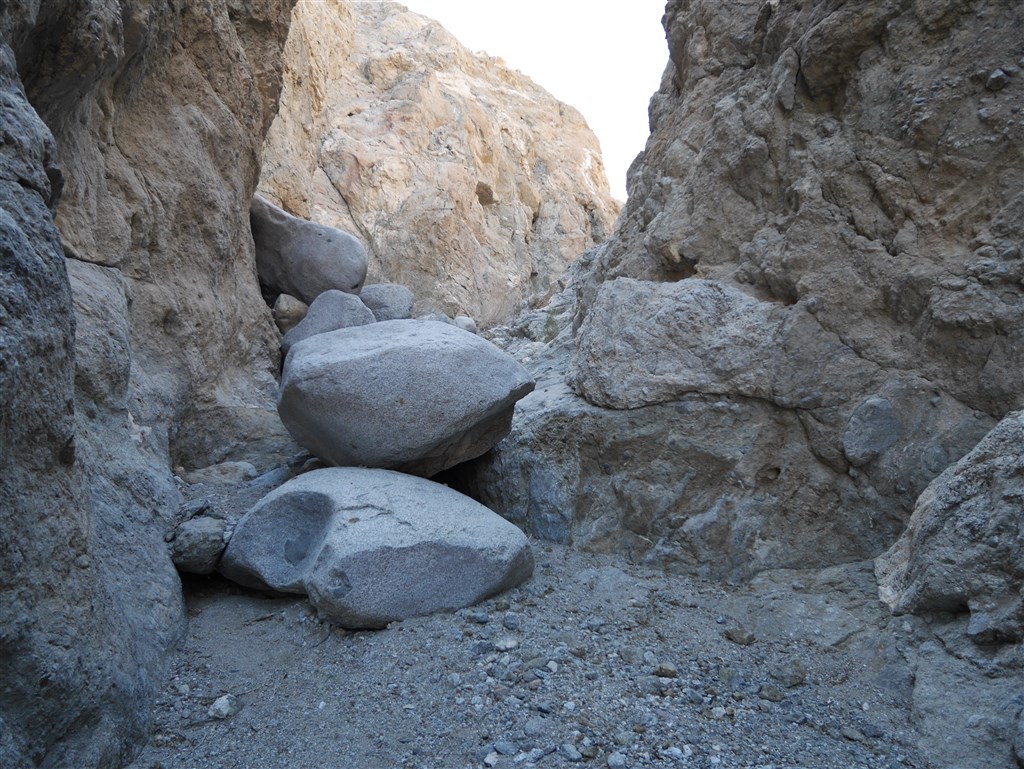
Metamorphic rock walls of Smoke Tree Canyon
The first part of our walk down the canyon was through a narrow channel surrounded by metamorphic rock walls cut out mostly by the horizontal force of large volumes of water moving down the canyon. Even without water present, there are still points with enough large boulders on the canyon floor that minor rock hopping was required to move forward. I found the rock walls and narrow space between them impressive. They formed an amazing and continually unfolding area to walk through. At the same time, I thought about the bird’s eye view and the extreme nature of this landscape. These walls weren’t carved out by a continuously flowing river at any time in their history. The space I was walking through was created by a long series of individual events. Events that continue to occur to this day making this scene only temporarily dry. Although I have no idea how big of a storm is required to create a depth of water that would be problematic for someone to be in this area, my guess is that it would be hard to gauge without extensive experience and that it would be best for novice desert visitors (like myself) to avoid areas like this during any rain. This isn’t some permanently dried up stream bed; it’s an active area fueled by the whims of weather patterns.

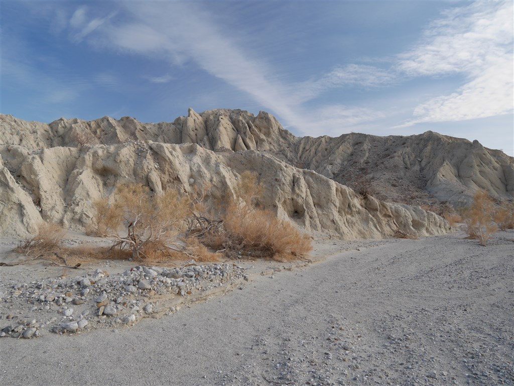
Sedimentary walls appear further down Storm Trees Canyon as it also widens.
Further down the dry stream bed, the canyon begins to widen and sedimentary walls–some still pretty tall– appear. I found the difference dramatic. Water must get comparatively slower in this area allowing debris to pile up and then erode. The size of some of the boulders up high appear to mark a past canyon floor height.

Lower walls take form as the canyon continues to widen.
As the canyon continues to widen, smaller height walls take form in the area between the larger walls defining the canyon. With those more interior walls down to about the standard height of a room, I began to start thinking about how close I was to being able to see over them.

Multiple channels below knee high emerged as the canyon continued to widen.
Soon, I was able to see over these interior dividers as their height dwindled down below knee high and the canyon opened up considerably. There were now choices regarding which channel I wanted to walk or if I preferred walking a straighter line through the more elevated and more rocky terrain between the channels. At this point the juxtaposition of all the different heights of the channels I had walked through had me thinking of the different perspectives each yielded. Looking at the ground, there were still more channels, just at a smaller scale. Channels that ants would find as enclosing as the ones I found higher up the canyon. This made me think of the film The Powers of Ten by Charles and Ray Eames. Standing in one spot I could see clearly several orders of magnification of scale relating to the impact of water moving through this landscape–all without water being present.

The curvy ridge like top, thinning out to almost a point, felt to me similar to the smaller shapes etched into the canyon floor and no higher than the soles of my shoes.
This idea of seeing similar things at different scales dominated my thinking for a large part of the remainder of my hike. I enjoyed looking at features in the landscape and considering the larger or smaller version. Upon seeing something I found interesting, I would look around to see if I could find a similar form at a different scale.
One of the many sculptural scenes as the canyon transitioned to a wash.
As the canyon gets wider and water has more area to disperse and slow down, the tallest enclosing walls begin showing erosion caused more by runoff from higher altitudes created by more of a sheet flow over cliff like edges. While the walls are obviously different as seen from the canyon floor, the source of this difference in the direction and depth of water flow generated erosion can be seen clearly from the views looking down on the canyon from the peak. The result is a more vertical from of erosion. By the time I reached a zone transitioning the canyon into something more like a wash, numerous more sculptural scenes emerged as the tallest canyon walls shortened continually until they ended altogether.

Smoke trees dominate the horizontal landscape as the canyon widens and the speed and depth of requisite water necessarily decreases.
The presence of smoke trees 2 further underscored for me the large amount of water that must make its way through the canyon at times. Looking back toward the mountains, standing in the completely dry landscape, the dramatically wetter reality was everywhere to be discerned. A rain at any time (not necessarily seasonal) could change the feel of the landscape profoundly, perhaps to the level of producing a flash flood or to a lesser degree simply greening the vegetation. As a result, my first impression of this landscape is that it has an extreme wet/dry duality that is there to see at all times.
Notes:
- We stayed in the Culp Valley Campground and walked the short Culp Valley Trail that is an extension of the campground. On our first day, after setting up camp, we hiked Lower Willows with a small and interesting side trip to a palm grove and culminating in a engaging view from the Santa Catarina Spring Monument area. On our second day we hiked Rock Tanks Loop with a small extension along a ridge to an unnamed peak. I took over 400 photos which I pared down considerably into 11 small galleries easily accessible from the links in this note. ↩
- The smoke trees, being so much more densely configured than the other vegetation outside the canyon implied for me significantly larger continuous water requirements for survival. Their presence suggested to me an indication of just how much water can flow through this area. I’ve since read a little bit about them and confirmed that they require a fair amount of water for survival. ↩