
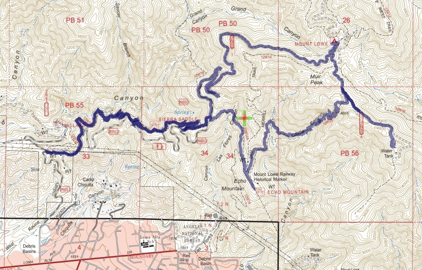
Track map Sunset Ridge to Muir Peak January 2016 using Backcountry Navigator (US Forest Service-2013 map) from my phone. Note: Muir Peak is placed incorrectly on the map. It is above the Water Tank indicated on the far right of the track.
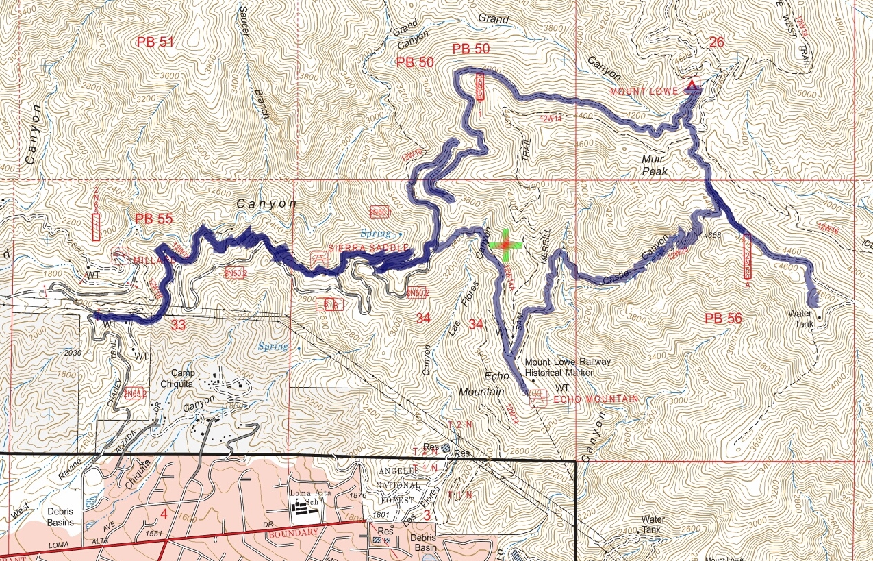
Track map Sunset Ridge to Muir Peak January 2016 using Backcountry Navigator (US Forest Service-2013 map) from my phone. Note: Muir Peak is placed incorrectly on the map. It is above the Water Tank indicated on the far right of the track.
