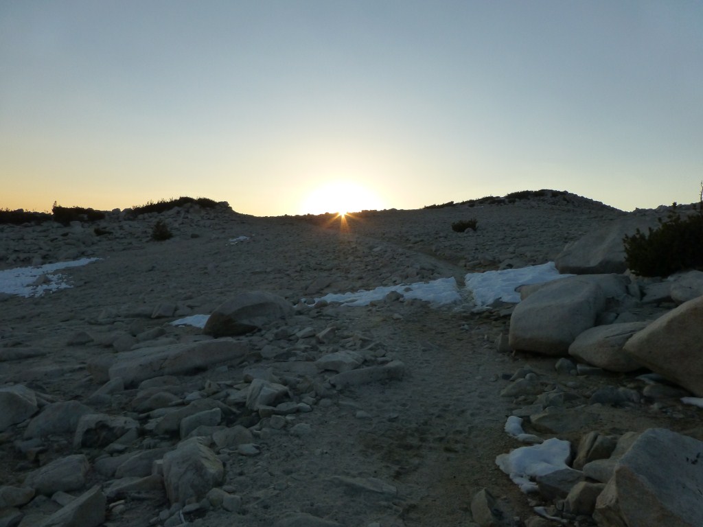
I spent last weekend at Kelly Camp. Fortunately I hiked there the week before and already knew there is no water at Kelly Camp. So I already planned my hikes around getting water at Columbine Spring prior to going. This trip was mostly about testing gear and getting more familiar with backpacking for some of the people I’m going to Mt. Whitney with at the end of July.

Icehouse Canyon Trail near Columbine Spring.
The weather Friday was cloudy and I was a little apprehensive that it might rain as the clouds were threateningly dark. Etienne and I hiked through the mist up to Icehouse Saddle where we finally got a glimpse of blue sky shortly after hearing some thunder. The clouds were making it up the canyon and I wasn’t sure if we were above them as much as we were ahead of their path.

Clouds breaking up as seen from the Ontario Peak Trail between Icehouse Saddle and Kelly Camp. (click to enlarge)
At the saddle we contemplated turning back as neither of us was enthusiastic about the prospect of spending the night in the rain. As we were considering our options it appeared that the clouds were breaking up. So we decided to stay the night. Although it was sunny at first at Kelly Camp, mist periodically made it up the mountain with the wind. Fortunately, a little mist was the extent of the moisture we experienced. It got windy and cold early and we sought shelter in our tents much earlier than if it was warmer.

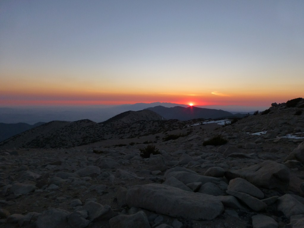
View toward the clouds from the Cucamonga Peak Trail.
On Saturday we hiked down to Icehouse Saddle and headed up the Cucamonga Peak Trail. When we got to the saddle between Buckhorn Peak and Cucamonga Peak we got our first view of the cloud cover below which extended below us as far as we could see. It was a great view that we saw numerous times going up the switchbacks of the trail. However, the clouds looked like they might make their way up the mountain at some point which I would have been more excited about as a possibility if I wasn’t planning to spend another night at Kelly Camp.

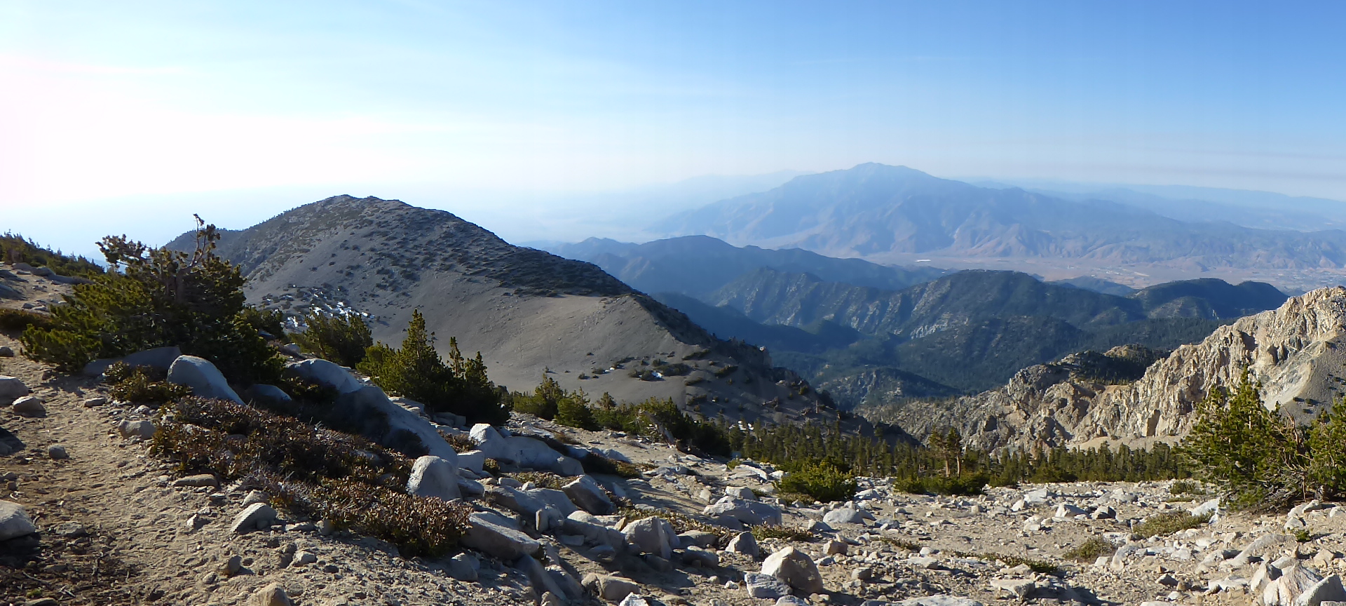
View toward Mt. San Gorgonio and Mt. San Jacinto from Cucamonga Peak with clouds breaking up.
We stayed at Cucamonga Peak for a while cooking lunch, enjoying the view, and watching the clouds break up yielding the sunny day the weather report predicted. We made it back down to Columbine Spring ahead of schedule so I hiked with Etienne down to the lower junction with the Chapman Trail where I met my wife and our friend Lorenzo.

View toward Mt. Baldy from the Cucamonga Peak Trail. (click to enlarge)
While Etienne hiked down to the trailhead, the three of us the hiked up to Columbine Spring to get water for the night and next day. We then made it up to a sunny Kelly Camp and enjoyed a much warmer night.

Ontario Peak Trail between Kelly Camp and the saddle with Buckhorn Peak.
On Sunday we were on the trail around 7:00 enjoying the fantastic morning light on the way to Ontario Peak where we stayed a while to snack and enjoy the view.

Kyle enjoying the view from Ontario Peak and Debbie trying to text our daughter. (Photo by Lorenzo)
After that we hiked to Bighorn Peak which provided excellent training going up the final steep slope to the peak and contending with windy conditions that we didn’t experience anywhere else that day.
From Buckhorn Peak we went back to Kelly Camp, cooked lunch, and packed up for our trek back down Icehouse Canyon.
Photos of Cucamonga Peak Trail (multiple trips)
Photos from Cucamonga Peak (multiple trips)
Photos of Ontario Peak Trail (multiple trips)
Photos from Ontario Peak (multiple trips)
Photos of Bighorn Peak Trail (multiple trips)
Photos from Bighorn Peak (multiple trips)